
How to use drone simulators for industry-specific training?
Srizfly recommends finding a suitable simulator training scenario based on your own usage scenario. It is not recommended to use drone simulation games for training because there are big differences between game scenarios and real scenarios, and using simulation games for training is not conducive to the performance of real scenarios. At present, there are mainly the following brands of drone simulators that support special training.
Choose a suitable drone simulator
1. Srizfly drone simulator This is an enterprise-level simulator that mainly provides simulation training for professional work scenarios. Srizfly currently supports training environments such as forests, seashores, streets, mountains, ruins, shopping malls, etc. The industry-level simulation application scenarios mainly include power search and inspection, geographic surveying and mapping, fire rescue, plant protection operations, etc.

2. Liftoff drone simulator The map details are excellent and the simulation degree is very high. Players can DIY their own aircraft, and every part can be replaced (propellers, batteries, motors, etc.). If you are a DIV enthusiast, this simulator will be a good choice.

3. Velocidrone drone simulator The configuration requirements are relatively low, and you can freely adjust the parameters to customize the quadcopter and flight environment. Flight control and customizability make practice flying feel very real and easier to transfer to real-life flying. Generally speaking, drone veterans prefer to use this simulator.

4. Uncrashed drone simulator …
Scenario selection for different industries
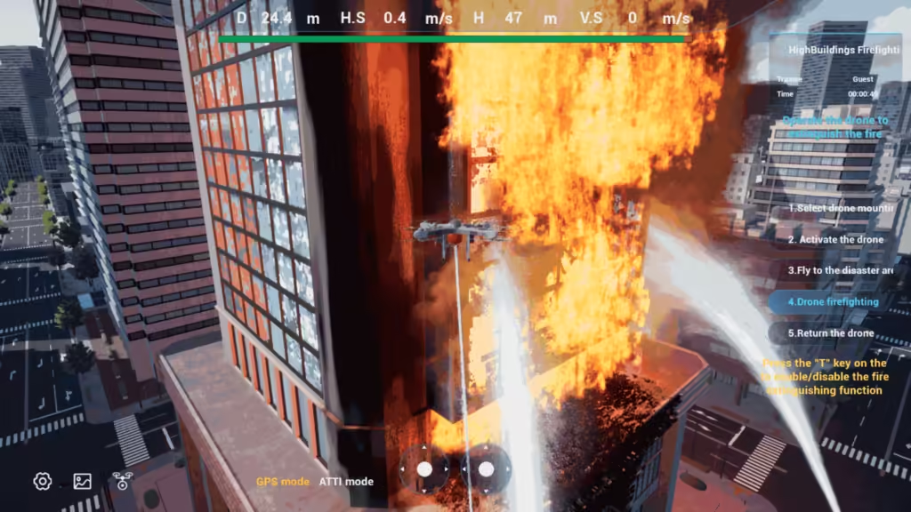
1. Firefighter
Fire extinguishing scene: training high-pressure sprinkler load selection, free implementation of fire extinguishing operations, support manual control of load fire extinguishing switch, real-time display of fire extinguishing progress during fire extinguishing; fire point and smoke point particle effects change in real time with the progress of fire extinguishing.

Improving firefighting skills through simulation training
2. Surveying and mapping personnel
Site surveying scene: campus, town, disaster area, mountain and other surveying and mapping scene training, training different weather scenes, including wind direction (east wind, west wind, south wind, north wind, southeast wind, northeast wind, southwest wind, northwest wind), wind speed (1-9 levels), weather (rain, snow, fog, dust), light and other weather conditions settings, support survey area planning settings, survey area planning can select survey area, clear survey area. Support survey area elevation viewing, elevation viewing based on two-dimensional map, view the lowest altitude and highest altitude of the survey area; view the altitude of the map area in real time.

Improving surveying and mapping efficiency through simulation training
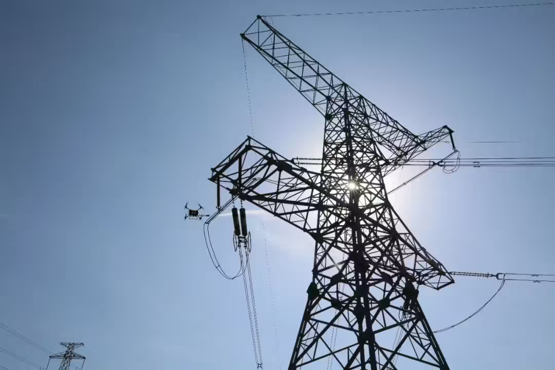
3. Power workers
Power inspection scenario: Trainees are fully trained in three aspects: patrol business logic, safety awareness, and control skills. The relevant standards of the power industry are used as business guidance, and the key points and precautions of safety regulations are run through the whole process. Through the pipeline training mode of “teaching → training → assessment → reinforcement”, the goal of standardized line patrol is achieved.

Improving safety and efficiency in electrical work
4. Cinematographer
Aerial simulation scenario: Training is based on shooting needs, and detailed flight routes are formulated, including take-off points, shooting points, landing points, etc., to ensure the safety and efficiency of the shooting process. Learn how to adjust the gimbal and camera settings of the drone, including focal length, exposure, white balance, etc., to shoot high-quality images.

Other professions…
Industries that may rapidly adopt drones in the future
Logistics and Delivery: With e-commerce growth, drones could revolutionize delivery services, especially for last-mile delivery. They are ideal for delivering packages in congested urban areas or to remote locations, reducing delivery time and lowering costs.
Construction and Infrastructure: Drones can conduct site surveys, monitor construction progress, inspect structures, and ensure site safety. They reduce the need for manual labor in dangerous situations, streamline project management, and improve data accuracy.
Public Safety and Law Enforcement: Drones assist with monitoring large crowds, aiding search and rescue missions, providing real-time surveillance in emergency situations, and supporting firefighting efforts. Their quick deployment enhances situational awareness and enables better-informed decisions.
Environmental Monitoring and Conservation: Drones help in monitoring ecosystems, tracking wildlife, assessing deforestation, detecting pollution, and responding to natural disasters. They allow real-time data collection with minimal environmental disturbance.
Insurance and Risk Management: Insurance companies can deploy drones to assess damage after natural disasters or accidents, improving claims processing times and risk assessments while minimizing the need for adjusters to enter potentially dangerous areas.
Real-life application cases in industry scenarios
About srizfly drone simulator
At present, the srizfly drone simulator mainly has simulation application scenarios in industries such as fire fighting, surveying and mapping, agricultural insurance, and electricity. If you need scene customization, please contact srizfly.
