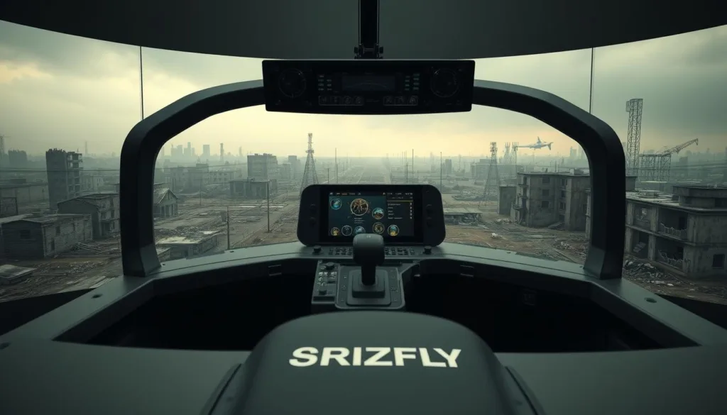
SRIZFLY delivers an enterprise-grade ukraine drone simulator built for real operations and fast onboarding. We combine accuracy, scale, and a safety-first design so teams can standardize workflows and accelerate readiness.
Our platform mirrors real work: planner-style mission preparation, wind awareness, and electronic warfare considerations shape structured training. You get role-based access, clear instructor tools, and controller support to make every session practical and measurable.
We focus on outcomes: repeatable missions, scenario branching, and performance analytics turn practice into on-site skills and confidence. The mission catalog covers inspections, public safety, agriculture, mapping, aerial photography, refinery checks, and more.
Try a zero-friction 10-day access trial to evaluate stability, content depth, and user experience. We listen to reviews and our community to refine modules while keeping enterprise SLAs and low IT overhead.
Key Takeaways
- Enterprise-ready: Built for operational workflows and measurable training.
- Practical skills: Missions and analytics translate to on-site performance.
- Breadth of content: Inspections, public safety, mapping, and more.
- Easy evaluation: 10-day access trial with low IT friction.
- Community-driven: User and instructor feedback guide updates and reviews.
SRIZFLY’s Vision: A mission-ready platform for enterprise and education
From SOPs to mission rehearsal, our platform turns procedures into practiced skills. We design learning paths that match real operations and audit expectations.
From software design to project implementation: SRIZFLY delivers a complete training ecosystem for enterprises and schools. We act as your developer partner, turning standards into content and assessment logic instructors can deploy with confidence.
From software design to project implementation: a complete training ecosystem
Curriculum to operations: Granular control settings, SOP checklists, and configurable gates let teams mirror field rules and build repeatable skills.
- Role-based paths and version storage policies keep content synchronized and preserve a compliant current state for audits.
- Structured feedback—rubrics, session logs, and scenario data—helps instructors coach and validate skills.
- Each mode—from fundamentals to advanced mission rehearsal—reflects operational constraints so training focuses on what matters.
- We support integration and documentation so your training program stays consistent across sites and partners.

| Capability | Enterprise Use | Instructor Tools |
|---|---|---|
| Curriculum & content | Custom pipelines for compliance | Editable lesson templates |
| Assessment & feedback | Skills matrices and logs | Rubrics and session reports |
| Governance | Role paths & version storage | Access controls and audit trails |
| Hardware support | Controller profiles (including fpv drone layouts) | Configurable control mappings |
We balance easy access for learners with governance for managers. The result is a scalable, mission-ready framework that accelerates onboarding and sustains continuous improvement.
ukraine drone simulator: real-world mission scenarios and training modes
Operators train on realistic tasks so every lesson maps directly to field performance. We design scenario flows that mirror utility checks, public safety drills, agricultural passes, and industrial inspections.
Start with fundamentals: the platform walks new pilots through throttle, attitude, orientation, and airspace basics. Short lessons and clear evaluations build piloting skills quickly.
Inspection and public safety paths: electric power workflows include tower climbs, line patrols, and substation fly-throughs with equipment ID and anomaly tagging. Public safety modules rehearse perimeter sweeps, hot-spot searches, and coordinated fire fighting drills.
Agriculture missions use geo-referenced maps and variable-rate workflows so agronomy teams turn aerial data into field actions across diverse areas. Surveying flows provide photogrammetry-ready plans, overlap guidance, GCP checkpoints, and QA mechanics for consistent datasets.
Refinery inspection covers confined spaces, thermal checks, and compliance-focused safety protocols. Aerial photography lessons teach camera control, exposure, gimbal moves, and shot planning for inspection and media work.
- Dedicated planner mode lets instructors set objectives, wind profiles, and hazard overlays before rehearsal.
- FPV drone simulator handling and fpv drones options support close-inspection mechanics when needed—always focused on safety and asset protection.
Outcome: every mode converts simulated experience into repeatable field skills and measurable performance improvements.
How SRIZFLY stands apart from combat-focused FPV simulators
SRIZFLY channels FPV control feel into safe, compliant training for industry users. We borrow the best handling cues from hobby culture but remove combat aims. Our design serves audits, not attacks.
Beyond battlefield mechanics: we translate checklists, SOPs, and environmental awareness into enforceable procedures. That means role-based gates, documented outcomes, and instructor-ready rubrics.

Planner-mode parallels for utilities and inspection
Planner features mirror pre-flight study—wind, interference, and site hazards—but focus on asset safety. Trainees prepare mission logs and evidence that supervisors can review and archive.
Controller support inspired by FPV culture
We support a wide range of controllers and calibrations familiar to players and developers. But we harden defaults for enterprise: documented dead zones, reproducible mappings, and validated calibration steps.
Content depth versus early access titles
Early access games move fast and change controls often. Enterprises need stable releases. SRIZFLY ships validated content, controlled updates, and reviews that stress reliability and audit readiness.
- Non-combat focus: fpv drone handling for inspection, not attack.
- Repeatable outputs: mission logs and checkoffs for compliance.
- Community-informed: we filter feedback through safety and developer gates.
Specs, integrations, and getting started with your 10‑day free trial
Validate performance quickly: we list recommended hardware, controller choices, and deployment steps so your team can test real workflows during the trial.
Recommended PC graphics and storage guidelines
For smooth playback on dense maps and analytics, choose discrete GPUs in the NVIDIA GTX class or AMD Radeon equivalents. Baseline comparables include NVIDIA GTX 660 / 1050 Ti and AMD Radeon HD 7950 / RX 560.
Plan for about 4 GB of local storage per workstation to cache missions, logs, and video exports. Add headroom if you keep long archives or high-resolution maps.
Controller options: FPV transmitters, gamepads, and keyboard/mouse
We support FPV transmitters via USB adapters, common gamepads, and keyboard/mouse. Control templates and dead-zone settings standardize feel across labs.
“Start with our controller presets, then tune rates and gimbal mapping to match on-site equipment.”
Deployment, version control, and role-based training paths
Deployment is installer-based with license provisioning and role permissions. IT can stage content packs, assign user groups, and set version storage policies to meet audits.
Planner mode and assessment exports integrate with LMS or archives. Use version storage to preserve training history and to track release dates for content updates.
| Item | Recommendation | Notes |
|---|---|---|
| GPU | NVIDIA GTX class / AMD Radeon equivalents | GTX 1050 Ti or RX 560 baseline for labs |
| Storage | ~4 GB per workstation (min) | Increase for map caches and long video exports |
| Controller | FPV transmitters, gamepads, KB/M | USB adapters and presets ensure fast onboarding |
| Deployment | Installers + license server | Role paths and version storage for audits |
- Try before you commit: use the 10‑day access to benchmark maps, confirm controller compatibility, and measure performance.
- We provide equipment checklists, control best practices, and a kickoff date to align goals and support windows.
Ready to test? Book your trial date and we’ll help you validate fit, performance, and integration before full release.
Conclusion
Effective training starts with mission realism and ends with verifiable skills in the field. We deliver a professional fpv training ecosystem that turns drones into reliable tools and builds operator confidence through structured missions and role-based modes.
Start your 10-day access trial now, and validate performance, storage needs, and controller equipment with real teams. We channel community feedback and developer updates into safe, non-combat content—never combat missions or attack tasks.
Decision-makers: rely on reviews, instructor notes, and user feedback captured during pilots to confirm fit before any release date. SRIZFLY helps you improve piloting skills, scale programs, and document progress across maps and operational areas.
FAQ
What is SRIZFLY’s advanced Ukraine drone simulator solution?
SRIZFLY delivers a mission-ready training platform for enterprises and education. We combine realistic flight physics, mission planning, and role-based scenarios to build piloting skills and operational workflows for inspection, mapping, public safety, and agriculture.
Who benefits most from this platform?
Organizations using aerial systems for tower inspection, mapping, logistics, agriculture, emergency services, and training institutions will see the greatest gains. Our tools reduce risk, improve efficiency, and accelerate competency across teams.
What training modes and mission types are included?
The package covers basic flight fundamentals, electric power inspections (towers, lines, substations), refinery and thermal checks, public safety drills including fire response, crop scouting, photogrammetry-ready surveying, and dedicated planner and rehearsal modes.
How does SRIZFLY differ from combat-focused FPV titles?
We prioritize enterprise compliance, checklists, and standard operating procedures over battlefield mechanics. Planner-mode integrates environmental factors like wind and EW awareness for utility and inspection missions, while controller support mirrors FPV best practices for precise control.
Can I use FPV transmitters and typical controllers with the software?
Yes. We support FPV-style transmitters, common gamepads, and keyboard/mouse setups. Controller mapping and sensitivity options let teams match their real-world equipment for seamless training transfer.
What are the recommended PC specs and storage requirements?
For smooth operation we recommend NVIDIA GTX-class or AMD Radeon GPUs, a modern multi-core CPU, 16GB+ RAM, and SSD storage. Higher-end GPUs improve visuals and fidelity for large maps and complex missions.
Is the product stable for enterprise use compared to early access games?
Yes. While we iterate, SRIZFLY focuses on stable workflows and version control to support operational training. Our release cadence emphasizes reliability and backward compatibility for team deployments.
How does version control and deployment work for teams?
We provide role-based training paths, centralized version storage, and deployment tools so admins can push updates, manage licenses, and maintain consistent training content across facilities.
What kind of metrics and feedback does the system offer?
The simulator tracks piloting skills, mission completion, points, and error logs. Instructors can review flight telemetry, checklist compliance, and debrief with replay tools to improve performance.
Are there combat missions or battlefield mechanics included?
Our focus is on enterprise and public-safety operations. We avoid combat-centric content; instead we model environmental risk, EW awareness, and mission-planning stresses relevant to civilian applications.
How can teams improve piloting skills using this platform?
Structured courses cover fundamentals, progressive difficulty missions, and scenario-based rehearsals. Realistic physics, controller tuning, and instructor-led debriefs accelerate skill acquisition and reduce training time.
Is there a free trial or demo available?
We offer a 10-day free trial so organizations can evaluate workflows, integrations, and content depth with no risk. The trial includes core mission packs and planner mode access.
What integrations are supported for mapping and photogrammetry workflows?
The system exports flight logs, waypoints, and imagery-compatible outputs for common photogrammetry pipelines and GIS tools, enabling smooth handoff to post-processing software used in surveying and mapping.
How do you handle community feedback and early access reviews?
We actively collect user feedback and reviews to refine mechanics and content. Our roadmap prioritizes stability, feature parity for enterprise needs, and responsiveness to trainer and operator input.
What resources are available for deployment and instructor setup?
We provide documentation, instructor guides, deployment checklists, and onboarding sessions. Our support team assists with controller calibration, role-based curriculum setup, and integration with existing training programs.

