Welcome to the exciting world where advanced technology meets hands-on training. This field is revolutionizing how energy professionals prepare for real-world challenges. It offers a powerful way to build expertise in a safe, controlled setting.
This guide walks you through mastering these innovative training tools. You will learn from basic concepts to advanced techniques that boost operational readiness. The goal is to transform theoretical knowledge into practical, impactful skills.
Whether you are a seasoned inspector or manage facility safety, this training is invaluable. It recreates complex environments like refineries and pipeline networks. You can practice navigation and data collection without the risks of a live site.
We will explore essential components like realistic scenario modeling and sensor integration. These elements mirror actual working conditions. By the end, you will know how to leverage this technology to build confidence and improve decision-making for your team.
Key Takeaways
- This training combines cutting-edge technology with practical skill development.
- It provides a completely risk-free environment to learn and make mistakes.
- Professionals can practice in virtual models of real-world industrial settings.
- The focus is on improving navigation, data gathering, and identifying issues.
- Effective training includes realistic scenarios and proper data analysis workflows.
- The ultimate goal is to increase team confidence and operational safety.
- This approach turns simulation from a simple exercise into a powerful tool for success.
Introduction to Drone Inspections in the Oil and Gas Industry
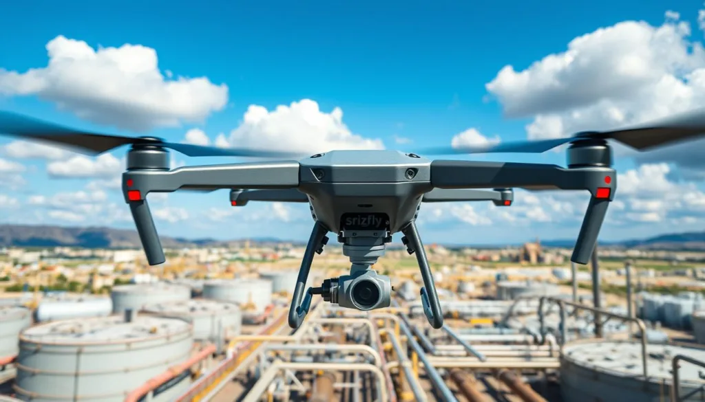
Modern asset monitoring has evolved dramatically with the integration of aerial technology solutions. These unmanned aerial vehicles carry sophisticated sensor arrays and high-resolution cameras. They provide detailed visual data for infrastructure assessment.

Traditional methods required personnel to climb towers or enter confined spaces. This exposed workers to significant hazards while consuming substantial resources. The energy sector needed safer, more efficient alternatives.
Since the early 2010s, aerial technology has transformed from novelty to essential tool. Advanced systems now deliver comprehensive data from safe distances. This approach enhances protection standards and reduces costs.
Integration with Geographic Information Systems creates actionable intelligence. This supports proactive decision-making across various sectors. Understanding these applications builds the foundation for effective training programs.
Understanding Oil and Gas Plant Drone Inspection Simulation
Cutting-edge training systems now offer realistic practice environments that mirror actual working conditions. These digital platforms create virtual replicas of industrial facilities where operators can safely master flight operations and data collection procedures.

The simulation technology digitally reconstructs complex refinery geometries with impressive accuracy. Trainees navigate through towering structures and confined spaces that present real navigation challenges. This prepares them for the specific demands of industrial assessment work.
Realistic scenarios include equipment malfunctions and adverse weather conditions. Trainees experience communication failures and unexpected obstacles they’ll encounter in field operations. The virtual environments incorporate accurate physics modeling that replicates how aerial vehicles respond to various conditions.
Operators can repeatedly practice critical procedures until they achieve mastery. This approach builds competent, confident professionals who handle specific industrial demands effectively. Skills developed in these digital environments transfer seamlessly to actual field deployment.
The ability to compress months of varied experience into intensive training accelerates workforce development. Organizations appreciate this method’s value in building capable teams ready for real-world challenges.
Key Benefits of Using Drone Simulation for Inspections
Virtual training platforms deliver remarkable advantages that transform how industrial assessments are conducted. These systems provide a foundation for developing expertise while minimizing real-world exposure. The approach delivers measurable improvements across critical operational areas.

Enhanced Safety Standards
Digital training environments eliminate physical hazards during the learning process. Operators practice complex maneuvers without endangering personnel or equipment. This builds confidence through repeated exposure to challenging scenarios.
Trainees develop instinctive responses to equipment failures and navigation errors. They learn to manage unexpected situations in consequence-free settings. This preparation significantly reduces field operation risks.
Cost and Time Efficiency
Simulation technology delivers substantial resource savings for organizations. Multiple operators can train simultaneously without scheduling conflicts. This approach eliminates equipment damage costs during skill development.
The compressed learning timeline accelerates workforce readiness. Teams achieve operational proficiency faster than traditional methods allow. This efficiency supports responsive scheduling for urgent facility needs.
Ongoing skill maintenance becomes practical between actual assignments. The combination of safety improvements and operational efficiency creates compelling value.
How Drone Simulation Enhances Operational Efficiency
Advanced preparation methods are transforming traditional approaches to industrial monitoring tasks. These digital platforms create significant workflow improvements that benefit entire organizations.

Standardized training procedures ensure every team member develops consistent competencies. This uniformity across operations leads to predictable, high-quality results. Teams follow established best practices from day one.
Virtual environments replicate specific facility layouts before field deployment. Operators arrive at job sites already familiar with potential challenges. This eliminates orientation delays that typically slow initial inspections.
Practice platforms allow testing and refining procedures without real-world consequences. Organizations can identify potential issues in advance. This proactive approach enhances both safety and efficiency.
Repeated maneuver practice builds operator confidence and speed. Skills developed virtually translate directly to faster task completion. The data collection process becomes more streamlined over time.
Organizations report reduced equipment downtime with well-trained teams. Fewer mistakes mean less supervision required. This creates a continuous improvement cycle that compounds benefits.
Standardized data capture ensures consistent quality across all inspections. Operators deliver uniform results that meet analysis requirements. This reliability transforms how teams approach complex monitoring operations.
Essential Components of Drone Inspection Technology
The backbone of modern aerial assessment systems lies in their sophisticated technological components. These integrated systems work together to deliver comprehensive monitoring capabilities.

Sensor and Imaging Technologies
Advanced sensors form the core of effective aerial monitoring. LiDAR systems provide precise 3D mapping for detailed structural analysis. Thermal imaging detects temperature variations that reveal hidden issues.
High-resolution cameras capture minute details with exceptional clarity. Specialized gas detection sensors identify environmental concerns. Each sensor type serves specific monitoring purposes.
“The right sensor combination transforms basic aerial footage into actionable intelligence.”
Data Collection and Analysis Tools
Modern systems feature intelligent data processing workflows. Real-time transmission allows immediate supervisor feedback. This enables focused attention on critical areas during operations.
AI-powered analysis tools automatically flag potential anomalies. Machine learning algorithms process massive datasets efficiently. These tools help operators distinguish normal patterns from genuine concerns.
| Sensor Type | Primary Function | Key Applications |
|---|---|---|
| LiDAR | 3D mapping & measurement | Structural assessment, volumetric calculations |
| Thermal Imaging | Temperature variation detection | Electrical fault identification, insulation checks |
| High-Resolution Camera | Detailed visual documentation | Corrosion detection, structural integrity |
| Gas Detection | Emission monitoring | Environmental compliance, leak detection |
Understanding these components ensures proper equipment selection. It also guides effective training program development. The right technology combination delivers optimal results.
Step-by-Step Guide to Setting Up a Drone Inspection Simulation
Building effective virtual training begins with a structured approach to configuration and planning. This systematic method ensures operators develop the right skills for real-world challenges. Each phase builds upon the previous one for comprehensive learning.
Pre-Flight Planning and Checklist
Thorough preparation sets the foundation for successful training sessions. Start by defining clear objectives for what participants should achieve. Consider the specific skills needed for different operational scenarios.
Review facility layouts and identify potential hazard areas. Establish clear flight boundaries and optimal sensor configurations. This planning phase mirrors real-world procedures exactly.
Simulation Setup and Calibration
Configuration requires attention to detail for realistic training environments. Digital replicas should match actual facility dimensions and equipment layouts. Environmental conditions must reflect those encountered during field operations.
Calibration ensures flight characteristics and sensor behaviors match real physics. This accuracy guarantees skills transfer effectively to actual work environments. Proper setup creates authentic learning experiences.
| Planning Phase | Setup Phase | Key Objectives |
|---|---|---|
| Define training goals | Configure virtual environments | Skill development focus |
| Identify hazard areas | Calibrate equipment responses | Safety preparation |
| Establish flight boundaries | Set environmental conditions | Realistic scenario creation |
| Determine sensor needs | Match real-world physics | Effective skill transfer |
Both phases work together to create powerful learning experiences. The combination prepares teams for complex data collection tasks. This approach builds confidence through systematic skill development.
Navigating Regulatory Compliance and Safety Standards
Navigating the complex landscape of regulatory frameworks is essential for successful aerial operations. Aviation authorities establish comprehensive rules that govern commercial UAV deployment. These requirements ensure safe operations around critical infrastructure.
Virtual training creates the perfect environment for learning these protocols. Operators practice within realistic scenarios that incorporate actual compliance requirements. They experience airspace restrictions and authorization procedures firsthand.
Understanding Industry Regulations
Industrial settings present unique safety challenges that demand specialized knowledge. Hazardous area classifications determine where aerial activities can occur safely. Understanding these classifications prevents potential ignition risks.
The training platform should incorporate regulatory scenarios that build proper habits. Operators learn to file notifications and coordinate with facility security teams. This preparation ensures smooth real-world operations.
Repeated practice makes safety protocols automatic responses rather than conscious decisions. Emergency procedures and equipment failure contingencies become second nature. This muscle memory reduces risks during actual assessments.
Ongoing training keeps teams current with evolving industry standards. Organizations that prioritize compliance training demonstrate due diligence. This approach supports regulatory approval applications and reduces liability exposure.
Virtual environments provide consequence-free learning opportunities. Operators experience what happens when regulations are violated without real penalties. These memorable lessons reinforce why compliance requirements exist.
Leveraging Machine Learning and AI in Drone Data Analysis
The integration of smart computing systems is transforming data interpretation in industrial monitoring. These advanced tools process complex information with remarkable precision.
Machine learning algorithms extract valuable patterns from massive datasets. They identify subtle anomalies that human analysts might overlook. This technology enhances decision-making across operations.
Predictive Maintenance with Learning Algorithms
Predictive maintenance strategies use learning algorithms to analyze historical information. These systems detect equipment degradation trends before failures occur. Organizations can schedule interventions proactively.
The approach moves beyond reactive responses to potential issues. Machine learning algorithms process thermal imagery and sensor readings effectively. This creates a comprehensive view of asset health.
Real-Time Data Analytics
Real-time analytics provide immediate alerts during monitoring activities. AI systems flag concerning conditions as they develop. Operators can focus attention on critical areas instantly.
This capability transforms how teams approach complex assessments. The technology supports faster, more informed decision-making. It represents a significant advancement in operational efficiency.
Practical Tips for Conducting Successful Drone Inspections
Mastering practical techniques ensures effective aerial assessment operations. These approaches transform complex tasks into manageable procedures.
Thorough preparation forms the foundation of every successful mission. Define clear objectives and establish communication protocols before beginning. This planning phase prevents unexpected challenges during data collection.
Equipment verification is crucial for reliable performance. Check battery levels and sensor functionality before each flight. Proper maintenance prevents mid-operation failures that compromise results.
Maintain constant awareness of your surroundings during activities. Monitor weather conditions and track power consumption regularly. Stay alert to potential hazards requiring immediate response.
“Systematic documentation provides context for accurate data interpretation during analysis.”
Establish clear safety zones around operational areas. This protects personnel not involved in the assessment process. Emergency procedures should become automatic through regular practice.
Coordinate scheduling with facility teams to minimize disruption. Post-flight debriefings identify improvements for future services. Continuous learning enhances performance across different environments.
Virtual training maintains proficiency between field assignments. It prepares teams for unfamiliar locations effectively. This approach builds confidence for complex industrial services.
Real-World Applications in the Oil and Gas Industry
Industry leaders have pioneered comprehensive programs that standardize aerial data collection across global operations. These initiatives demonstrate practical benefits that extend beyond theoretical advantages.
Case Studies and Success Stories
ExxonMobil’s GAVIS program represents a benchmark for large-scale implementation. This initiative coordinates aerial monitoring across more than 100 locations worldwide.
The program focuses on challenging infrastructure assessment scenarios. It addresses elevated structures and confined spaces where traditional methods pose significant risks.
Strategic partnerships with qualified service providers ensure consistent quality. This approach maintains safety standards while delivering reliable data for maintenance planning.
| Application Area | Key Challenge | Operational Benefit | Technology Used |
|---|---|---|---|
| Pipeline Monitoring | Leak Detection | Early Warning System | Thermal Imaging |
| Offshore Platforms | Structural Integrity | Reduced Downtime | 3D Modeling |
| Refinery Assets | Complex Geometry | Rapid Data Capture | High-Resolution Cameras |
| Flare Stack Inspection | Height Access | Enhanced Safety | Autonomous Flight |
These real-world examples validate training investments by showcasing complex operational scenarios. They demonstrate how proper preparation leads to successful field deployment and improved asset management.
Integrating Drone Simulation with Traditional Inspection Methods
Building comprehensive assessment capabilities means recognizing the complementary nature of different methodologies. The most effective programs combine virtual practice with established hands-on techniques.
Training scenarios should compare the same challenge using both approaches. Operators develop judgment about which method delivers superior results for specific situations. This prepares personnel to make informed decisions during actual operations.
These systems complement rather than replace conventional techniques. Rope access technicians and specialized inspectors bring irreplaceable expertise that remote sensing cannot duplicate. Their hands-on testing and detailed measurements remain essential for thorough assessments.
Virtual environments teach coordination between aerial surveys and ground teams. Drones conduct rapid initial scans that guide traditional inspectors to specific problem areas. This integration creates significant workflow efficiencies across maintenance schedules.
Organizations maintaining proficiency in both methodologies demonstrate operational resilience. They can continue assessments even when weather or technical issues prevent aerial deployment. This balanced approach ensures consistent monitoring quality.
Enhancing Skill Sets Through Continuous Training and Simulation
The journey toward mastery doesn’t end with initial certification but continues through regular practice. Ongoing development programs ensure your team maintains peak performance between field assignments.
Regular practice sessions prevent skill degradation during slower seasons. This approach keeps your personnel ready for unexpected challenges.
Workshops and Hands-On Training
Effective workshops blend classroom learning with practical simulation exercises. This combination builds both theoretical knowledge and real-world capabilities.
Advanced scenarios challenge experienced operators with rare but critical situations. These exercises expand their problem-solving skills beyond routine inspections.
Personalized development plans target individual strengths and weaknesses. This focused approach maximizes training efficiency for each team member.
Cross-training programs create versatile personnel who can handle multiple roles. This flexibility ensures operational continuity during personnel changes.
Organizations that invest in continuous development attract top talent. They build reputations for excellence in safety and operational effectiveness.
Advanced Drone Technologies: Beyond Visual and Line of Sight Capabilities
Operating beyond the constraints of direct observation represents a quantum leap in remote monitoring technology. BVLOS approved solutions enable aircraft to function thousands of kilometers from operators.
These advanced capabilities are particularly valuable for monitoring extensive pipeline networks. They eliminate the need for constant repositioning in remote areas.
BVLOS operations rely on sophisticated automated navigation systems. Redundant communication links and detect-and-avoid technologies ensure safe autonomous flight.
Training for these missions requires specialized simulation scenarios. Operators must learn to manage aircraft without direct visual confirmation.
Regulatory frameworks demand rigorous safety demonstrations before approval. Comprehensive risk assessments and proven operator competency are essential.
Advanced platforms incorporate realistic communication challenges. They prepare teams for signal degradation and temporary link losses.
Line of sight limitations have historically restricted operations to accessible areas. BVLOS approvals eliminate these constraints, opening new application possibilities.
Organizations use simulation extensively to validate procedures. This approach builds proficiency before actual beyond visual line of sight flights.
Evaluating Performance and Data Quality in Drone Inspections
Quality assurance in remote assessment operations depends on establishing clear evaluation criteria. These metrics help teams measure both operational efficiency and the reliability of collected information.
Effective programs track completion time, area coverage, and flight safety. They also verify that imagery meets resolution standards and provides adequate overlap. This ensures comprehensive documentation without gaps.
Key Metrics and Assessment Techniques
Standardized techniques eliminate variability between different operators. Consistent results enable meaningful comparisons across multiple assessment cycles. This supports accurate degradation rate calculations.
Quality control combines automated checks with expert human review. Automated systems verify resolution and metadata. Specialists then confirm defects and investigate anomalies.
“Regular performance evaluations using both field information and simulation exercises provide comprehensive feedback for continuous improvement.”
Benchmarking against industry standards identifies improvement opportunities. This approach ensures that monitoring programs deliver their intended value for asset management.
Future Trends in Oil and Gas Drone Inspection Simulation
Next-generation aerial assessment methods are poised to revolutionize how we approach facility maintenance. These innovations will fundamentally change operational strategies across the energy sector.
Emerging Technologies and Innovations
Fully autonomous operations represent the next frontier. Artificial intelligence will handle routine monitoring tasks without direct human control. This enables continuous surveillance at costs comparable to traditional periodic assessments.
Swarm coordination allows multiple aircraft to work together simultaneously. They can survey extensive infrastructure in dramatically reduced timeframes. Enhanced sensor systems will detect subtle anomalies that current technology misses.
Digital twin integration creates virtual facility models that simulate real-world behavior. This supports predictive maintenance strategies that prevent equipment failures before they occur.
Market Projections and Industry Impact
The market for these services continues rapid expansion as costs decline and regulations mature. Organizations recognize the compelling return on investment that advanced programs deliver.
Industry impact extends beyond cost savings to fundamental operational transformations. Companies shift from reactive approaches to proactive asset management strategies. This represents a seismic change in how critical infrastructure receives maintenance attention.
Simulation platforms will evolve with photorealistic graphics and AI-generated scenarios. The convergence of 5G networks and edge computing enables real-time data processing directly on aircraft.
Conclusion
Looking back across the comprehensive training landscape, the strategic advantages of simulated practice environments stand out as game-changing innovations. These virtual platforms build essential skills while eliminating real-world hazards.
Mastering aerial assessment methods through digital training creates a solid foundation for field work. Organizations gain measurable benefits in team capability development and risk reduction. The return on investment becomes clear through improved operational outcomes.
As technology continues advancing, these training solutions will evolve alongside new capabilities. They ensure personnel stay current with industry best practices and regulatory requirements. This approach supports long-term excellence in infrastructure monitoring.
The future points toward increased utilization of remote assessment services. Virtual preparation serves as the essential bridge between emerging technologies and practical deployment. Start your training journey today to position your team for success.
FAQ
What are the main advantages of using simulation for training?
Simulation training dramatically improves safety standards by allowing personnel to practice in a risk-free virtual environment. It also boosts cost and time efficiency by reducing the need for physical assets and minimizing operational downtime during the learning process.
How does this technology help with regulatory compliance?
Using advanced simulation helps teams understand and adhere to strict industry regulations. It prepares operators for real-world scenarios, ensuring that all flight operations, whether within visual line sight or beyond, meet necessary safety and compliance requirements.
Can drone data be used for predictive maintenance?
Absolutely. By leveraging machine learning algorithms, the data collected from these unmanned aircraft can analyze equipment health. This enables predictive maintenance, helping to identify potential issues before they lead to failures, thus protecting critical infrastructure.
What kind of data is collected during an inspection?
High-resolution sensors on the aircraft capture detailed imagery and other vital information. This data collection is crucial for assessing asset integrity and provides comprehensive coverage of hard-to-reach areas, which is then analyzed for insights.
Are these inspections conducted beyond visual line of sight?
Yes, advanced capabilities now allow for missions beyond visual line of sight (BVLOS). This expands the operational range significantly, enabling inspections of vast industrial sites and complex infrastructure without compromising on safety or data quality.

