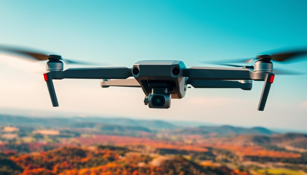
Have you ever wondered how today’s technology can dramatically enhance the accuracy and efficiency of aerial mapping? The DJI 30T, also known as the Matrice 30T, introduces cutting-edge features designed specifically for professionals in mapping and surveying. This sophisticated DJI drone 30T is not just another flying machine; it’s a robust tool that delivers stunning imaging and precise data collection, making it one of the best DJI 30T drones on the market.
Equipped with advanced sensors and imaging technologies, the DJI 30T excels in various applications, from aerial photography to thermography and detailed topographical analysis. Its advanced aerial mapping capabilities ensure users across different industries can rely on it for high-quality results without compromising on portability. In the following sections, we’ll explore how this remarkable surveying drone combines ease of use with powerful performance.
Key Takeaways
- The DJI 30T offers up to 6 hours of flight time with its internal and external battery configuration.
- It features multiple cameras, including a 12 MP wide camera and a 48 MP zoom camera for diverse imaging needs.
- This drone is optimized for a temperature range of -20° C to 50° C, making it versatile for different environments.
- With an ingress protection rating of IP55, the DJI 30T is designed to withstand various weather conditions.
- It supports dynamic thermal imaging and laser rangefinding, enhancing its applicability in professional surveying tasks.
Introduction to the DJI 30T
The DJI 30T represents a significant milestone in drone technology, offering a variety of features that cater to the needs of aerial mapping and surveying professionals. Its innovative design and functionality make it a highly sought-after tool in its class. Understanding the DJI 30t features and specifications provides insights into why this drone stands out in the market, particularly for those involved in detailed mapping applications.
Overview of Features
The DJI 30T incorporates advanced capabilities suitable for various environmental conditions. This drone is equipped with:
- High-performance cameras: A 48MP zoom camera capable of 5x to 16x optical zoom and a thermal imaging sensor.
- Compact and foldable design: Facilitates easy transport and quick setup for immediate use.
- Robust redundancy systems: Enhance mission reliability during challenging flights.
- IP55 weather rating: Allows operation in diverse weather conditions, making it the best DJI 30t drone for mapping tasks.
Key Specifications
Diving into DJI 30t specifications reveals its impressive performance capabilities:
| Specification | Details |
|---|---|
| Max Flight Time | 41 minutes |
| Max Altitude | 7,000 meters |
| Wind Resistance | 15 m/s |
| Hovering Accuracy | ±0.1 m (Vision System) |
| Thermal Accuracy | ±2°C or ±2% |
Applications in Aerial Mapping
Applications in aerial mapping utilize the DJI 30T due to its effective imaging capabilities and reliable data processing. This drone serves as a vital instrument for:
- Topographic surveys that require detailed terrain analysis.
- Environmental monitoring to assess land use and habitat changes.
- Infrastructure inspections, ensuring safety and efficiency in development projects.
Benefits of Using the DJI 30T
The DJI 30T stands out in the crowded field of drones, particularly for its impressive imaging capabilities, reliability during flights, and intuitive controls. These features make it the best DJI drone for imaging, appealing to a wide range of users including those in surveying, agriculture, and emergency response.
Enhanced Imaging Capabilities
One of the key benefits of the DJI 30T is its exceptional imaging capabilities. Equipped with a 48MP main camera, a 12MP wide camera, and a 640p thermal camera, it excels in gathering detailed images suitable for diverse applications. Users can capture stunning 8K photos and 4K videos at 30 frames per second, making it the best DJI drone for imaging. This combination allows professionals to perform thorough inspections, create 3D models, and enhance search-and-rescue operations with precision thermal imagery.
Improved Flight Stability
Ensuring robust performance, the DJI 30T features advanced stability technology. Dual-vision and Time-of-Flight (ToF) sensors provide 360-degree obstacle detection, contributing significantly to DJI 30t stability. Users can maintain drone flight stability even in challenging environments with high winds or varying temperatures. This remarkable capability enhances safety and reliability during critical missions, allowing uninterrupted operation.
User-Friendly Controls
Operating the DJI 30T is a breeze due to its user-friendly controls. The DJI RC Plus controller is equipped with a seven-inch high-definition screen, allowing effortless navigation and enhanced visibility. The DJI 30t user-friendly controls include customizable buttons and an upgraded DJI Pilot 2 interface which streamlines access to essential features with a single tap. This simple layout ensures that both novice and experienced users feel confident during their operations, differentiating it from other competing models and establishing it as a top choice within the industry.
| Feature | Details |
|---|---|
| Flight Time | Up to 41 minutes |
| Main Camera Resolution | 48MP |
| Thermal Camera Resolution | 640p |
| Max Transmission Distance | 15 km (FCC) |
| Obstacle Avoidance Range | 0.6-38 m Forward, 0.5-33 m other directions |
| Weight | 3.7 kg |
| Operating Temperature | -20°C to 50°C |
Compatibility with SRIZFLY Drone Simulator
The integration of the SRIZFLY drone simulator with the DJI M30T offers a remarkable training experience tailored to enhance piloting skills. With advanced realism, pilots can hone their abilities in a simulated environment, eliminating risks typically associated with live flight practice.
How SRIZFLY Works with DJI M30T
The SRIZFLY drone simulator provides a platform that closely mimics the functionality of the DJI M30T. This compatibility with dji m30t allows users to engage in realistic flight scenarios, making it easier to transition from simulation to real-world flying. Pilots can explore controls and maneuvers effectively, significantly enhancing their flying confidence.
Benefits of Simulation Training
The benefits of drone simulator training are manifold. Participants experience a decrease in training costs, as virtual scenarios negate the need for extensive airborne practice. Users can experiment and learn from various flight techniques and emergency protocols, fostering a well-rounded skill set. SRIZFLY training advantages include improved reaction times, problem-solving abilities, and comprehensive preparation for actual aerial operations.
Compatible Remote Controllers
For flexible training experiences, the SRIZFLY simulator supports various DJI M30T simulator compatible controllers. This remote controller compatibility ensures that users can utilize their existing flight controllers, tailoring the simulation to their preferences and training needs. Such adaptability reinforces the simulator’s value as an educational tool for aspiring and seasoned pilots alike.

Advanced Surveying Capabilities
The DJI 30T drone showcases remarkable advancements in surveying through the integration of LiDAR technology and real-time data processing. This combination not only enhances the efficiency of mapping projects but also improves overall accuracy and safety in various applications.
LiDAR Technology Integration
LiDAR technology in drones is a game changer for surveyors and mapping professionals. The DJI 30T LiDAR capabilities enable precise distance measurements and intricate surface mapping. This technology proves essential for disciplines such as forestry, archaeology, and urban planning. It reduces the reliance on ground control points, allowing for faster and more accurate data collection, while also eliminating dangers associated with traditional ground surveying methods.
Real-Time Data Processing
The DJI 30T excels in real-time data processing in drones, empowering users to analyze information on the fly. This feature facilitates quick decisions during flights, crucial for operations requiring immediate insights. With DJI drone live data capabilities, users can monitor their missions closely, adjusting flight paths or data collection methods as needed, thereby enhancing operational efficiency.
Topography Mapping Applications
Topography mapping with DJI 30T presents numerous advantages for mapping large land areas. Equipped with various sensors, the drone captures high-resolution data that assists in land development, environmental assessments, and resource management. The performance of this drone reduces project timelines significantly compared to traditional methods, marking it as a preferred tool for aerial mapping solutions.
| Feature | Details |
|---|---|
| LiDAR Technology | Precise distance measurements, detailed surface mapping |
| Data Processing | Real-time analysis, immediate actionable insights |
| Topography Mapping | High-resolution data, efficient land development |
| Time Efficiency | Reduces project timelines significantly |
Enhanced features like thermal imaging are vital for identifying temperature inconsistencies and energy inefficiencies. The DJI 30T, when paired with simulation training resources such as advanced drone training solutions, can further integrate skills essential for effective surveying operations.
Flight Performance and Endurance
The DJI 30T stands out in the realm of drones due to its impressive performance metrics. Understanding its capabilities including flight time, range, wind resistance, and battery management adds value for users seeking efficient aerial solutions.
Max Flight Time and Range
The DJI 30T boasts a remarkable DJI 30t flight time of up to 41 minutes, providing extensive coverage for demanding missions. With a maximum flight range of 15 km in optimal conditions, users can explore various surveying and mapping applications without frequent interruptions.
Wind Resistance and Stability
Designed for resilience, this drone offers DJI 30t wind resistance capable of withstanding winds up to 15 m/s. Stability during flight is paramount, ensuring that the drone maintains flying stability even in challenging weather conditions. This robust construction and advanced sensor integration contribute to consistent data quality regardless of environmental impacts.
Battery Management Solutions
Efficient DJI 30t battery management features significantly enhance operational capability. The drone includes hot-swapping technology, which permits quick battery changes, ensuring minimal downtime during missions. With up to 6 hours of cumulative drone battery life, users can confidently tackle extended operations knowing that robust power solutions are in place.
| Feature | Specification |
|---|---|
| Max Flight Time | 41 minutes |
| Max Flight Range | 15 km (unobstructed) |
| Wind Resistance | 15 m/s |
| Battery Capacity | 5880 mAh |
| Cumulative Battery Life | Up to 6 hours |
Software and Firmware Updates
Keeping your DJI 30T in peak condition requires attention to software maintenance, which includes regular firmware updates. The importance of these updates cannot be overstated, as they directly impact the drone’s performance and capabilities. Regular DJI 30t firmware updates optimize features and security, while enabling enhanced compatibility with new accessories.
Importance of Regular Updates
Regularly updating DJI 30T firmware is crucial for several reasons:
- Improved security protocols to protect your drone from potential vulnerabilities.
- Enhanced flight stability, ensuring smoother operation and better handling.
- Access to the latest DJI 30t firmware features that expand the drone’s functionality.
- Compatibility with newly developed software applications.
How to Update Your DJI M30T
Updating DJI 30t is straightforward and can be accomplished via Wi-Fi connectivity. Follow these steps for successful firmware update procedures:
- Connect the drone to a reliable Wi-Fi network.
- Open the DJI Pilot 2 app and navigate to the firmware update section.
- Check for available updates and select the desired version.
- Initiate the download; the estimated time to complete is around 5 minutes.
- Follow on-screen prompts to finalize the installation.
Features of the Latest Firmware
The latest firmware update introduces several significant upgrades. Notable enhancements include:
| Feature | Description |
|---|---|
| Vertical Mapping Accuracy | Improved to 22.3 cm with a Ground Sample Distance (GSD) of 5.01 cm/px. |
| Smart Inspection Efficiency | Allows for photographing multiple target objects from a single waypoint. |
| Automatic Target Framing | Eliminates manual framing, increasing operational efficiency. |
| Burn Protection for Thermal Camera | Reduces risk of damage, potentially extending the lifespan of the camera system. |
| Data Quality in Low Light | Improved recovery metering functions that record brightness values. |

User Experience and Support
The experience of using the DJI 30T is enriched through valuable community feedback. Many users have shared their insights on performance, as seen in DJI 30T reviews. The general sentiment highlights the drone’s robust capabilities, adaptability in various flight conditions, and exceptional imaging quality. User feedback on DJI drones frequently praises the upgraded pilot interface, which simplifies operation and enhances the overall flying experience.
Community Feedback and Reviews
Numerous users have taken to forums and review sites to express their enthusiasm about the DJI 30T. Common themes emerging from these discussions include:
- Strong flight stability in diverse weather conditions.
- High-definition imaging features, suitable for professional applications.
- User-friendly controls that cater to both beginners and seasoned pilots.
Customer Support Options
When encountering issues, customers can rely on DJI customer support for assistance. The company offers various options such as:
- Dedicated helplines for immediate support.
- Online chat services for quick troubleshooting.
- Extensive knowledge bases filled with FAQs and guides.
These drone support services prove essential for resolving concerns efficiently, whether it’s a firmware update or technical difficulties. Customers appreciate quick response times and actionable advice, which simplifies the troubleshooting process. In circumstances involving more complex issues, like the example of a user who needed to return their drone for service, the support team continues to play a crucial role.
Resources for New Users
New users can access a broad range of resources for DJI 30T users to maximize their understanding of the drone’s capabilities. These resources include:
- Operating manuals detailing all functionalities.
- Video tutorials providing step-by-step guidance.
- Community forums facilitating discussions among users.
Collectively, these resources help novices navigate their new drones effectively, paving the way for exciting aerial experiences without unnecessary hurdles. As users explore these materials, they can quickly become proficient in leveraging their device for mapped surveys and other applications.
| Customer Experience Aspect | Details |
|---|---|
| Feedback on Performance | Positive reviews highlighting stability and imaging quality. |
| Support Options | Helplines, online chat, and knowledge base. |
| Resources for New Users | Operating manuals, video tutorials, and forums. |
Safety Features of the DJI 30T
The DJI 30T incorporates industry-leading safety features, making it an outstanding choice for professional drone pilots. Understanding these elements is essential for enhancing your drone operational safety. This section delves into the advanced technologies that set the DJI 30T apart in terms of safety precautions.
Obstacle Avoidance Technology
The DJI 30T is equipped with six-way DJI 30T obstacle avoidance sensors, utilizing dual-vision and Time-of-Flight (ToF) technology. This comprehensive system allows for real-time detection and feedback, significantly reducing the risk of collisions. By continually scanning the environment, the drone maintains a safe flight path, helping pilots adhere to recommended drone safety protocols.
Fail-Safe Mechanisms
In emergencies, the DJI 30T fail-safe features ensure the device operates reliably. Built-in mechanisms activate automatically to facilitate safe landings or returns home if the signal is lost or the battery becomes critically low. This reliability is vital for maintaining mission integrity in challenging conditions.
Tips for Safe Flying
To maximize the safety features of drones like the DJI 30T, pilots should adopt safe flying tips for DJI 30T which enhance overall safety. Below are some important considerations:
- Conduct thorough pre-flight checklists to verify equipment functionality.
- Maintain visual contact with the drone at all times.
- Stay informed about local regulations and weather conditions.
- Perform regular maintenance checks on the drone.
- Utilize the drone’s built-in safety features fully.
Future of Aerial Mapping Drones
The landscape of drone technology is rapidly changing, driven by significant advancements and an increasing demand for efficiency in various sectors. As we look towards the future trends in drones, we can expect enhanced autonomy and improved data collection capabilities to become commonplace, effectively revolutionizing the aerial mapping advancements we witness today. More specifically, the integration of artificial intelligence in decision-making processes will transform how we approach aerial surveying, leading to more streamlined operations across industries.
Trends in Drone Technology
Experts anticipate that DJI will continue to roll out new features in their upcoming DJI drones, specifically targeting improved payload capacities, battery life enhancements, and innovative imaging technologies. These DJI future releases aim to not only boost operational efficiency but also enhance data analytics capabilities, which is essential for professionals relying on precision in their mapping and surveying tasks. As the technology matures, the evolution of aerial surveying will reflect a more interconnected approach, combining various sensors and software solutions for comprehensive data analysis.
Predictions for DJI’s Next Releases
Given the trajectory of drone technology, the evolution of aerial surveying techniques will likely see increased use of sophisticated sensors combined with machine learning algorithms. This combination will enable real-time data analysis and heightened accuracy, marking a significant step forward in future surveying methods. Moreover, as drones like the DJI Matrice 30 gain popularity, we can anticipate a wider acceptance of drone utilization in fields such as environmental monitoring, urban planning, and construction management.
FAQ
What are the key features of the DJI 30T?
The DJI 30T features advanced imaging capabilities with a 48MP zoom camera, thermal imaging, and dual-vision sensors for real-time obstacle detection. Its compact design allows for easy transport and rapid deployment, making it suitable for various aerial mapping and surveying applications.
How long can the DJI 30T fly on a single charge?
The DJI 30T offers an impressive maximum flight time of approximately 41 minutes, allowing for extensive area coverage in a single mission.
Can I use the SRIZFLY simulator for DJI 30T training?
Yes, the SRIZFLY drone simulator is compatible with the DJI 30T and offers a detailed training environment for pilots to practice controls and maneuvers without the risk associated with actual flight.
What industries can benefit from using the DJI 30T?
The DJI 30T is primarily used in industries like agriculture, construction, environmental monitoring, and emergency response for applications such as topographic surveys and infrastructure inspections.
How does the LiDAR technology enhance the DJI 30T’s capabilities?
The integration of LiDAR technology in the DJI 30T allows for precise distance measurements and detailed surface mapping. This is particularly useful in fields like forestry, archaeology, and urban planning.
What safety features does the DJI 30T have?
The DJI 30T is equipped with advanced obstacle avoidance technology, powered by dual-vision and Time-of-Flight (ToF) sensors. Additionally, it includes fail-safe mechanisms that ensure safe landings in emergencies.
How can I update the firmware on my DJI 30T?
You can easily update the firmware of the DJI 30T via Wi-Fi connectivity through the DJI Pilot 2 interface. This process is straightforward and ensures that your drone operates at peak performance with the latest features.
What customer support options are available for DJI 30T users?
DJI provides extensive customer support through dedicated helplines, online chat services, and a comprehensive knowledge base. Users can find assistance and solutions to ensure smooth operations.
What improvements can be expected with the latest firmware updates?
The latest firmware updates for the DJI 30T introduce enhancements in flight safety protocols, new mission planning functionalities, and increased compatibility with third-party payloads, maximizing the drone’s operational capabilities.

