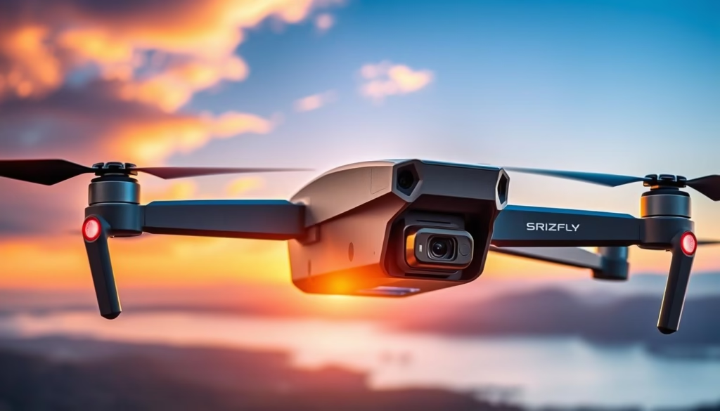
Are you prepared to discover whether the latest addition to the DJI Mavic series can truly outperform its predecessors in precision and performance? The DJI Mavic 3E represents a significant advancement in DJI’s surveying drone capabilities, providing unparalleled functionality for high-accuracy aerial mapping and surveying applications. This review will delve into the Mavic 3E’s noteworthy features, performance metrics, and its unique offerings compared to other models, especially the Mavic 2 Pro and the Phantom 4 RTK. Operating under the SRIZFLY model designation, this drone with a 4K camera is engineered for professionals seeking comprehensive technical solutions without compromising on quality.
Key Takeaways
- The DJI Mavic 3E incorporates a 20 MP 4/3 CMOS main camera with 5.1K video resolution.
- Claimed flight time of 46 minutes, with actual performance achieving around 35 minutes under test conditions.
- Enhanced operational capabilities with a mechanical shutter for high-precision mapping.
- RTK module enables centimeter-level accuracy in large-scale surveys.
- Advanced flight features include TimeSync 2.0 for precise alignment across components.
Overview of the DJI Mavic 3E
The DJI Mavic 3E stands out in the DJI Mavic series, designed specifically for professional applications in surveying and mapping. With advanced capabilities, this model is enhanced with the optional SRIZFLY Drone Simulator, which enables operators to practice flight maneuvers in a controlled environment. Built for precision, the DJI Mavic 3E offers exceptional specifications that cater to the needs of technical enthusiasts and professional drone operators.
Introduction to SRIZFLY Model
The SRIZFLY model enriches the operation of the DJI Mavic 3E, featuring integrated flight interfaces and advanced software capabilities. This combination enables seamless mission planning and execution, making it an ideal choice for those focusing on high-accuracy applications. The potential of this model is further amplified when paired with the RTK module, allowing for centimeter-level accuracy in data collection.
Key Specifications
| Feature | Specification |
|---|---|
| Camera Sensor | 4/3 CMOS, 20 MP |
| Max Flight Time | 45 minutes |
| Surveying Area Coverage | Up to 2 square kilometers |
| Max Ascent Speed | 6 m/s (Normal), 8 m/s (Sport) |
| Max Flight Distance | 32 km |
| Weight | 915 g (without accessories) |
| Obstacle Avoidance | Omnidirectional with zero blind spots |
| Charging Time | Approx. 1.5 hours (with 100W charger) |
| Operating Temperature Range | -10° to 40° C (14° to 104° F) |
Advanced Features of the Mavic 3E
The DJI Mavic 3E stands out in the crowded drone market, particularly for professionals seeking a drone with 4K camera capabilities, advanced surveying capabilities, and extended flight time. This model offers numerous features designed to maximize efficiency and data collection accuracy.
Enhanced Camera Capabilities
At the heart of the Mavic 3E is a robust 20MP wide-angle camera equipped with a 4/3 CMOS sensor. This advanced imaging system significantly enhances image quality, essential for detailed mapping and effective surveying. A mechanical shutter minimizes motion blur, enabling precise capture during fast-paced survey flights. This model has a rapid shooting interval of just 0.7 seconds, allowing for expedient data acquisition over vast areas.
Flight Time and Range
The DJI Mavic 3E offers impressive flight dynamics, allowing for up to 45 minutes of continuous operation. During each flight, this drone can efficiently cover up to 2 square kilometers, making it suitable for extensive surveying tasks. The inclusion of a lithium battery supports faster charging with a 100W hub, allowing for quick turnarounds between missions.
Intelligent Flight Modes
This model features advanced flight capabilities, including APAS 5.0 for automated obstacle avoidance and enhanced safety during flights. The drone utilizes data from multiple sensors, ensuring rerouting around potential obstacles. Additionally, Integrated AirSense technology provides live alerts for nearby manned aircraft, enhancing overall flight safety. The Mavic 3E’s smart features, such as Live Mission Recording and Corridor Mission Planning, further streamline mission planning for users focused on efficient and accurate surveying.

| Feature | Mavic 3E Specifications |
|---|---|
| Camera Resolution | 20MP, 4/3 CMOS Sensor |
| Mechanical Shutter | Yes |
| Flight Time | Up to 45 minutes |
| Coverage Area | Up to 2 sq km |
| Shooting Interval | 0.7 seconds |
| Obstacle Avoidance | APAS 5.0 |
| Charging Capability | 100W Fast Charging Hub |
| Safety Features | Integrated AirSense Technology |
Performance Analysis
The DJI Mavic 3E sets a new standard in drone performance, particularly in flight stability and accuracy during navigation. The integration of advanced technologies allows operators to achieve reliable and precise outcomes in various applications, making it an indispensable tool for professionals.
Flight Stability and Control
Exceptional flight stability is one of the defining features of the DJI Mavic 3E. Its sturdy build enables it to endure challenging weather conditions, with a wind resistance capability rated up to 27 mph. This robustness ensures that the drone maintains control and flight stability, crucial for high-stakes professional operations, particularly during data collection and surveying tasks.
GPS and Navigation Accuracy
Equipped with cutting-edge GPS functionality, the DJI Mavic 3E offers unparalleled precision navigation. It features an optional RTK module, which allows for centimeter-level surveying accuracy. The drone can effectively cover up to 2.25 square kilometers per flight while maintaining orthophoto accuracy, making it ideal for applications such as mapping and 3D modeling. The mechanical shutter further enhances its performance by eliminating the jelly effect during fast movements, a significant advantage for tasks requiring high precision.

| Feature | Details |
|---|---|
| Weight | 1.97 pounds (895 grams) |
| Maximum Flight Time | 46 minutes |
| Battery Capacity | 5,000 mAh |
| Main Camera Sensor Size | 4/3-inch |
| Precision Navigation | Centimeter-level accuracy with RTK module |
| Coverage Area | Up to 2.25 square kilometers per flight |
Comparison with Other DJI Models
In the realm of high-performance drones, the DJI Mavic 3E stands out when compared to other notable models like the DJI Mavic 2 Pro. This section delves into the unique attributes that differentiate the Mavic 3E from its predecessor, providing insights for potential buyers and drone enthusiasts seeking a thorough comparison of DJI drones.
Mavic 3E vs. Mavic 2 Pro
The DJI Mavic 3E features various enhancements over the DJI Mavic 2 Pro. Both drones deliver impressive imaging capabilities, yet the Mavic 3E benefits from:
- Superior image sensor size of 1/1.3-inch compared to the 1-inch sensor on the Mavic 2 Pro.
- Longer maximum flight time, reaching up to 31 minutes, exceeding the performance of the Mavic 2 Pro.
- Enhanced data collection capabilities with advanced RTK functionalities designed for surveying purposes.
- Increased maximum transmission distance of 14 km, which aids in expanded operational range.
This distinction in features signifies a substantial advancement in technology, making the Mavic 3E a preferred choice for many professionals.
Unique Selling Points of Mavic 3E
The DJI Mavic 3E introduces several distinctive features crucial for specialized applications:
- Advanced flight stability and control, ensuring precise maneuverability in various conditions.
- Comprehensive support for a range of navigation systems, including GPS, Galileo, and BeiDou, enhancing positional accuracy.
- Increased operational capabilities within a broad temperature range of -10° to 40° C, making it suitable for diverse environments.
- Impressive video resolution capabilities, with support for 4K resolutions up to 100 fps.
These factors contribute to the DJI Mavic 3E‘s reputation as a leading option for professionals requiring advanced functionality and reliable performance.
Conclusion and Recommendations
The DJI Mavic 3E proves to be a powerful tool for professional surveyors, urban planners, and environmental analysts. With its robust 4/3” CMOS sensor and 20-megapixel camera, this drone with 4K camera capability excels in delivering precise aerial imagery, ideal for extensive mapping tasks. The increased flight time of up to 45 minutes enhances operational efficiency, reducing the need to frequently recharge during extensive projects.
Ideal Use Cases for the Mavic 3E
The Mavic 3E is particularly suited for surveying applications involving agriculture, construction, and infrastructure inspection. Its RTK module, with accuracy rated at 1.0 cm horizontally and 1.5 cm vertically, offers centimeter-level precision crucial for rigorous surveying standards. The 56x hybrid zoom capability is invaluable for conducting detailed inspections from a safe distance. Additionally, the drone’s ability to operate in extreme temperatures down to 14°F makes it versatile across various climates.
Final Thoughts on Performance
In summary, the DJI Mavic 3E stands out as an elite choice for professionals seeking a reliable and efficient surveying drone. Its advanced features, including a customizable remote controller and the DJI O3 image transmission system, provide exceptional user experience and operational reliability. While the upfront investment of close to $4,000 may appear significant, the enhanced capabilities and potential for long-term operational savings justify the cost for serious applications in the field.
FAQ
What is the maximum flight time of the DJI Mavic 3E?
The DJI Mavic 3E has a maximum flight time of up to 45 minutes, allowing for extended missions without the need for frequent battery changes.
How does the camera of the Mavic 3E improve aerial mapping quality?
The Mavic 3E is equipped with a 20MP 4/3 CMOS sensor and a mechanical shutter, which reduces motion blur and enhances image quality for high-resolution aerial mapping.
What are the weather conditions the Mavic 3E can operate in?
The Mavic 3E is designed with enhanced build quality and has wind resistance rated up to 27 mph, making it reliable in various weather conditions.
How does the Mavic 3E compare with the Phantom 4 RTK in terms of surveying?
The Mavic 3E offers superior imaging capabilities, longer flight times, and advanced RTK functionalities, making it a more suitable option for high-accuracy surveying applications than the Phantom 4 RTK.
What is the significance of the RTK module for the Mavic 3E?
The optional RTK module allows the Mavic 3E to achieve centimeter-level accuracy, crucial for precise mapping and surveying tasks in professional applications.
Can the Mavic 3E be used for professional agriculture applications?
Yes, the DJI Mavic 3E is ideal for agricultural applications, providing high-quality aerial imagery that can assist in crop monitoring and analysis.
What kind of users would benefit most from the Mavic 3E?
The Mavic 3E is recommended for professional surveyors, urban planners, and environmental analysts who require precise aerial imagery for various mapping and surveying tasks.
Is there any software for simulating flights of the Mavic 3E?
Yes, the SRIZFLY Drone Simulator can be used for simulating flights and training operators to effectively utilize the Mavic 3E’s capabilities.

