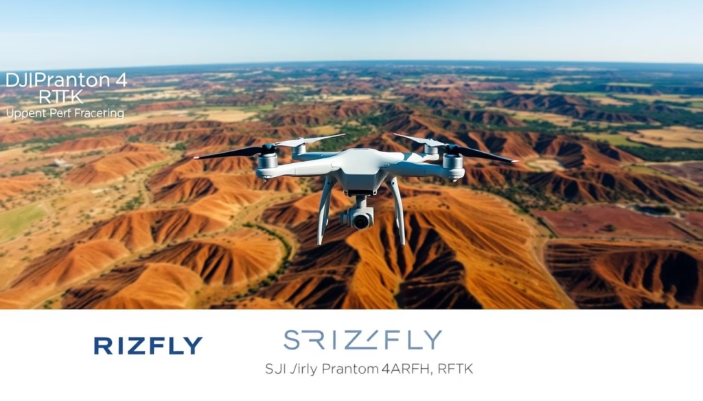
The DJI Phantom 4 RTK represents a significant advancement in precision aerial mapping technology, tailored specifically for professionals demanding high accuracy in their data collection processes. This sophisticated surveying drone is equipped with integrated RTK technology, enhancing positioning precision to centimeter-level accuracy, making it suitable for various mapping applications, including surveying and agricultural monitoring. Featuring a compact design, robust construction, and superior data collection capabilities, the DJI Phantom 4 RTK positions itself as a market leader in the domain of precision drone mapping.
Key Takeaways
- The DJI Phantom 4 RTK offers centimeter-level positioning accuracy with its integrated RTK module.
- It features a high-resolution 20-megapixel camera with a 1-inch CMOS sensor.
- The drone has a maximum transmission range of 4.3 miles (7 km) for unobstructed operation.
- Vertical and horizontal hover accuracy is enhanced to ±0.1 m when RTK is enabled.
- With a maximum flight time of approximately 30 minutes, it is efficient for extensive mapping tasks.
- The product package includes 12 distinct pieces, ensuring a complete surveying solution out of the box.
- Ground sample distance (GSD) of 2.74 cm at 100 meters flight altitude meets industry standards for accuracy.
Introduction to the DJI Phantom 4 RTK
The DJI Phantom 4 RTK represents a significant advancement in drone mapping technology. This drone is widely recognized for its exceptional performance in various industries such as construction, agriculture, and environmental research. Through the implementation of advanced RTK positioning systems, the Phantom 4 RTK ensures reliable and precise geolocation data. This capability allows operators to create accurate aerial imagery, streamlining processes that require topographical analysis.
Overview of Drone Mapping Technology
Drone mapping technology utilizes unmanned aerial vehicles to capture geographical data, allowing for high-resolution topographic maps and models. The DJI Phantom 4 RTK enhances this process through its integration of RTK systems. These systems enable positioning accuracy within 1 cm + 1 ppm horizontally and 1.5 cm + 1 ppm vertically. Such precision ensures detailed data collection that can significantly reduce the reliance on ground control points, thus speeding up workflow and enhancing efficiency.
Importance of RTK Accuracy
RTK accuracy plays a crucial role in the success of drone mapping tasks. By minimizing errors in geolocation data, the DJI Phantom 4 RTK contributes to higher fidelity in surveying operations. Accurate data collection becomes vital when projects demand adherence to strict timelines and budgets. Furthermore, the technical specifications of the Phantom 4 RTK, such as the 1-inch, 20-megapixel CMOS sensor capable of capturing stunning 4K images, underscore its capabilities in delivering high-quality results.
Key Features of the DJI Phantom 4 RTK
The DJI Phantom 4 RTK stands out in the drone mapping arena due to its advanced specifications and capabilities. Central to its functionality is the integration of RTK technology, offering exceptional positioning accuracy essential for precise mapping tasks. This section delves into the key features that make the DJI Phantom 4 RTK an industry leader.
RTK Technology Explained
The RTK technology incorporated in the DJI Phantom 4 RTK enables real-time, centimeter-level accuracy for various applications. It achieves horizontal positioning accuracy of 1 cm + 1 ppm and vertical accuracy of 1.5 cm + 1 ppm, making it ideal for high-precision projects. This technology utilizes a D-RTK 2 Mobile Station, allowing connection via OcuSync or a 4G Dongle. The calibration process ensures that positioning data aligns closely with the drone’s camera, enhancing the integrity of gathered data.
High-Resolution Camera Specifications
Equipped with a high-resolution camera, the DJI Phantom 4 RTK features a 1-inch, 20-megapixel CMOS sensor. This sensor allows for capturing images with a maximum resolution of 5472×3648 pixels. With a Ground Sample Distance (GSD) of approximately 2.74 cm at a flight altitude of 100 meters, the quality of imagery produced is exceptional for mapping and surveying applications. The camera can record in 4K video at 30 frames per second, further bolstering its capabilities for data collection.
Advanced Flight Modes
The advanced flight modes available in the DJI Phantom 4 RTK enhance operational flexibility and data collection accuracy. Modes such as photogrammetry and waypoint navigation enable users to configure flight paths tailored to specific mapping needs. The DJI GS RTK application provides intuitive control and data management, ensuring a streamlined workflow during aerial surveying tasks.
| Feature | Details |
|---|---|
| Camera Sensor | 1 inch, 20 megapixels |
| Horizontal Accuracy | 1 cm + 1 ppm |
| Vertical Accuracy | 1.5 cm + 1 ppm |
| GSD at 100m Altitude | Approximately 2.74 cm |
| Video Resolution | 4K (3840×2160) at 30p |
| Operating Temperature | 32° to 104° F (0° to 40°C) |
| Flight Time | Approx. 30 minutes |
Benefits of Using DJI Phantom 4 RTK for Mapping
Utilizing the DJI Phantom 4 RTK presents significant advantages, particularly in the realm of precision mapping. This advanced drone provides exceptional accuracy, enabling professionals to gather reliable data crucial for effective surveying.
Enhanced Precision and Accuracy
The benefits of dji phantom 4 rtk include unparalleled accuracy, achieving a precision level of 1/10ft (3cm). The integration of the TimeSync system coordinates the positioning data with the optical center of the camera, resulting in enhanced accuracy. This meticulous approach ensures that surveyors can depend on the data collected for critical decision-making.
Time Efficiency in Surveying Tasks
Traditionally, surveying tasks could span days or even weeks, yet the DJI Phantom 4 RTK radically transforms this timeline, reducing survey times to mere hours. With the ability to gather accurate data frequently, surveyors can now focus on critical analysis and decision-making rather than prolonged data collection processes. The efficiency gained through the reduction of required ground control points further amplifies this time-saving capability.
Improved Data Collection Techniques
Enhanced data collection techniques stand out as one of the drone surveying benefits associated with the Phantom 4 RTK. The onboard GNSS module achieves vertical accuracy of 0.1 feet with a single GCP, differentiating it from non-RTK models that require significantly more ground control points. The integration of AeroPoints facilitates consistent ground control, leading to maximized efficiency in data collection.

Comparing DJI Phantom 4 RTK with Other Drones
In the realm of drone technology, particularly for surveying applications, the DJI Phantom 4 RTK stands out for its precision and innovative features. A detailed analysis reveals how it compares against other models in terms of performance and cost-effectiveness, highlighting its advantages and limitations.
Performance vs. Competitors
The drone performance comparison showcases several key factors that elevate the DJI Phantom 4 RTK above other drones. Its RTK technology allows for enhanced imagery accuracy through onboard GNSS receiver capabilities, which leverage data from both base stations and satellites. This connection is fundamental for obtaining reliable positional data during flight.
- RTK Status Indicators: These color-coded indicators facilitate ease of monitoring during operations.
- Error Monitoring: X, Y, and Z RMS Errors can be tracked; for instance, a black indicator signifies errors ≤ 0.1m.
- Connectivity Requirements: The need for an iPad with internet access to maintain RTK signals ensures consistent performance.
While the Phantom 4 covers a maximum area of 35 ha (86 ac) at a GSD of 1.8 cm (0.7 in)/px, other models, such as the WingtraOne, can cover up to 110 ha (272 ac), suggesting a trade-off between coverage and precision, particularly valued in surveying tasks.
Cost-Effectiveness Analysis
A cost-effective surveying drones analysis indicates that although the initial cost of the DJI Phantom 4 RTK may be higher, the operational efficiencies gained—particularly in data quality and accuracy—justify the investment. The long-term benefits include:
- Improved accuracy leading to fewer survey errors.
- Enhanced data collection methods, yielding better insights.
- The potential for significant time savings in project execution.
The balance between cost and capability signifies why many professionals within the surveying field prefer the DJI Phantom 4 RTK for tasks demanding high precision.
Practical Applications of DJI Phantom 4 RTK
The DJI Phantom 4 RTK demonstrates remarkable versatility across a diversity of sectors. Its capabilities revolutionize tasks in agriculture, construction, and environmental research, allowing for enhanced efficiency and precision.
Agriculture and Crop Monitoring
Through agricultural drone use, the Phantom 4 RTK enhances crop monitoring and precision farming. Farmers utilize its high-resolution imagery and centimeter-level positioning data to assess land health and optimize resource allocation. The technology aids in reducing rework by 25%, ensuring more accurate planning for crop management.
Construction Site Surveys
In construction, applications of DJI Phantom 4 RTK streamline site surveys and urban planning. Real-time data transmission over distances up to 7 km allows for detailed site evaluations. This drone’s speed, four times greater than traditional methods, minimizes labor and increases overall productivity on construction projects.
Environmental Research Projects
Environmental mapping benefits significantly from the Phantom 4 RTK’s precise capabilities. Researchers deploy it for habitat studies and topographic assessments, acquiring data formats like GeoTIFF and KML for effective analysis. The reliability of the drone ensures that surveys can be conducted with minimal anchor points, enhancing data density and accuracy.
Getting Started with the DJI Phantom 4 RTK
Embarking on the journey of operating the DJI Phantom 4 RTK requires an understanding of essential elements to ensure optimal performance and safety during flight. Key components include the necessary equipment, proper setup, and adherence to safety guidelines for drones.
Essential Equipment and Accessories
To maximize the effectiveness of the dji phantom 4 rtk setup, users should gather vital equipment, including:
- D-RTK 2 Mobile Station for differential data support
- Extra batteries to extend flight duration
- Propeller guards to protect the drone during operations
- Carrying case for secure transport
- Mobile device for app control and data management
Initial Setup and Calibration
Proper setup and calibration are crucial for enabling the Phantom 4 RTK to deliver precise results. Follow these steps:
- Install the DJI GS RTK app on your mobile device.
- Charge the drone batteries fully before flight.
- Calibrate the compass and perform GPS initialization.
- Set up the D-RTK 2 Mobile Station for real-time data.
- Perform a pre-flight check to ensure all systems function properly.
Safety Guidelines for New Pilots
Understanding and implementing safety guidelines for drones is vital for all pilots, particularly newcomers. Adhering to these principles will promote safe operational practices:
- Maintain visual line-of-sight with the drone at all times.
- Fly within designated airspace and comply with local regulations.
- Conduct a thorough pre-flight checklist to identify potential issues.
- Be aware of changing weather conditions during flight.
- Ensure the surrounding area is clear of people and obstacles to avoid accidents.

Mastering Flight with SRIZFLY Drone Simulator
The SRIZFLY drone simulator offers an innovative platform for pilots to develop their skills and gain confidence in operating drones, particularly the DJI Matrice 300 RTK. By simulating real-world flying conditions, this training tool enhances learning through various practical applications and scenario-based exercises.
Overview of the SRIZFLY Simulator
Designed for professional drone operators, the SRIZFLY drone simulator replicates the experience of flying the DJI Matrice 300 RTK in a variety of environments. The interface is user-friendly, allowing for intuitive navigation through flight patterns and emergency response drills. Integration of advanced technologies ensures realistic flight dynamics, helping pilots become adept at managing both standard and challenging flying situations.
Benefits of Simulator Training
Utilizing simulator training presents numerous advantages for drone operators:
- Risk-Free Practice: Pilots can refine their operational skills without the potential hazards associated with live flight.
- Cost Efficiency: Simulator training reduces the need for physical resources and minimizes wear and tear on actual drones.
- Flexible Learning: Operators can train at their own pace, focusing on specific drone training methods that enhance their expertise.
- Immediate Feedback: The simulator delivers real-time responses to pilot actions, allowing for effective adjustments and accelerated learning.
Features Supporting DJI Matrice 300 RTK
The SRIZFLY drone simulator includes several key features specifically designed to support the capabilities of the DJI Matrice 300 RTK:
| Feature | Description |
|---|---|
| Realistic Flight Environment | Simulates various weather conditions and terrains to provide comprehensive training experiences. |
| RTK Integration | Allows for training in RTK positioning functionalities, enhancing accuracy in real-world scenarios. |
| Multi-User Training | Facilitates group training sessions, promoting teamwork and collaboration among drone operators. |
| Performance Metrics | Tracks progress and skill development through detailed analytics on training performance. |
Integrating DJI Phantom 4 RTK into Workflows
To maximize the potential of the DJI Phantom 4 RTK, effective integration into professional workflows is paramount. This entails a detailed understanding of software compatibility for data processing as well as the adoption of best practices to streamline operations.
Software Compatibility for Data Processing
Utilizing the right data processing software is essential for handling the outputs of the DJI Phantom 4 RTK efficiently. The PPK correction process can leverage publicly available software and correction data sources such as RTKLIB, NOAA, and NASA. This compatibility allows operators to process data through five major steps, enhancing the overall functionality of drone mapping. Key files required for PPK corrections include:
- The “rover” file from the Phantom 4 RTK RINEX data.
- The “base station” file using publicly available CORS data.
- The broadcast ephemeris data from NASA CDDIS.
For optimal results, the recommended version of RTKLIB is 2.4.3, with specific settings such as:
- Positioning Mode: Kinematic
- Frequencies: L1+L2
- Filter Type: Combined
- Elevation Mask: 15 degrees
- Recorded Dynamics: On
- Satellites Included: GPS, GLONASS
- Integer Ambiguity Resolution: Fix and Hold
The final output will include data fields that are crucial for subsequent photogrammetric analyses, enabling operators to integrate DJI Phantom 4 RTK data seamlessly into their existing systems.
Best Practices for Workflow Efficiency
Implementing efficient drone workflows involves meticulous planning and organized data management. Prior to flights, pre-planning flight paths can greatly reduce time on-site, while thoughtful data organization will enhance retrieval and usage post-flight. Steps beyond PPK processing include converting coordinates from WGS84 and performing accurate photogrammetric processes. Furthermore, checking results against control points is vital for verifying accuracy.
By adopting these practices, users can fully leverage the capabilities of the DJI Phantom 4 RTK, achieving centimeter-level accuracy and efficient data collection across various applications. This strategic integration allows professionals to meet rigorous project demands and maintain competitive advantages.
Maintenance and Care for DJI Phantom 4 RTK
Ensuring the DJI Phantom 4 RTK operates efficiently requires consistent attention to maintenance and care. Implementing effective drone care tips not only prolongs the life of the equipment but also guarantees peak performance during operations.
Regular Maintenance Checks
Conducting regular checks plays a crucial role in the overall functioning of the DJI Phantom 4 RTK. Key aspects include:
- Battery Health: Inspect battery health by checking for swelling, damage, or unusual wear. Properly maintaining the Intelligent Flight Battery, which has a capacity of 5870 mAh, contributes significantly to extended flight times.
- Propeller Condition: Ensure propellers are free of cracks or deformation. Regularly replacing worn propellers can prevent performance issues.
- Firmware Updates: Software updates occur approximately 3-4 times a year. Keeping the firmware current is essential for operational reliability, particularly since the last update for the remote controller was on September 21, 2023.
- Visual Inspection: Examine the drone for any physical damage, ensuring no loose components or debris could affect flight.
Troubleshooting Common Issues
Operators may encounter common issues while utilizing the Phantom 4 RTK. Identifying and addressing these problems promptly can prevent disruptions. Here are typical issues and suggested solutions:
- Connectivity Problems: Ensure stable connections with the RTK system by checking cable integrity and signal strength. The maximum transmission range of 4.3 miles needs a clear line of sight for optimal performance.
- Calibration Discrepancies: Misalignment in calibration can lead to inaccuracies in data collection. Follow the manufacturer’s guidelines for recalibrating the drone’s systems to restore accuracy.
- Battery Issues: Regular maintenance includes battery testing. DJI’s maintenance program allows for testing of up to 2 batteries at no extra charge. Additional batteries require a nominal fee.
Implementing effective dji phantom 4 rtk maintenance routines contributes to long-term operational success and minimizes downtime. Ensuring proper operational checks and swift troubleshooting are critical for delivering consistent results in precision mapping and aerial data collection tasks.
Future of Drone Mapping Technology
The landscape of drone mapping technology is evolving rapidly, driven by advancements in artificial intelligence and machine learning. These innovations not only enhance the efficiency of data analysis but also enable sophisticated decision-making processes. As the future of drone technology unfolds, new capabilities emerge that reshape how mapping tasks are performed.
Emerging Trends in Drone Innovation
Key trends in drone mapping innovations indicate a transition toward automated flight planning and real-time data processing. With these advancements, drone operators can expect:
- Increased efficiency in data capture and processing.
- Enhanced precision through improved imaging sensors.
- Ability to access challenging terrains that are unsafe for traditional methods.
- Real-time analysis, facilitating quicker decision-making.
Potential Upgrades for DJI Phantom Series
The upcoming upgrades for DJI Phantom drones, particularly the Phantom 4 RTK model, promise significant improvements. Expected upgrades include:
- Greater processing power to handle complex data quickly.
- Advanced imaging sensors that provide higher resolution outputs.
- Improved battery life for extended flight capabilities.
- Enhanced connectivity features for seamless integration into mapping workflows.
Conclusion: Elevating Your Surveying Capabilities
The DJI Phantom 4 RTK proves to be an essential choice for professionals aiming to enhance their surveying capabilities. This drone’s advanced RTK technology allows for positional accuracy within 1 centimeter, establishing its reliability in precision drone mapping. A summary of DJI Phantom 4 RTK highlights its capacity to significantly reduce measurement errors and improve efficiency; post-calibration data indicates a drop in Z value errors from 1.3 meters to under 100 mm, underscoring its capability.
Moreover, the application of RTK technology minimizes the need for extensive ground control points (GCPs), thus accelerating site calibrations and reducing overall project turnaround times. The ability to capture survey data in minutes rather than hours or days contributes significantly to efficiency improvements. In the context of drone mapping conclusions, the DJI Phantom 4 RTK stands out as a model that balances performance and operational practicality.
As the industry continues to evolve, the integration of advanced drone surveying technologies like the DJI Phantom 4 RTK is expected to shape future surveying methodologies. By incorporating factors such as enhanced data accuracy and efficient workflow processes, it positions itself as a leading solution for professionals in various sectors seeking to refine their operational capabilities in an increasingly competitive landscape.
FAQ
What is the primary advantage of utilizing the DJI Phantom 4 RTK for aerial mapping?
The primary advantage of the DJI Phantom 4 RTK is its integrated RTK technology, which enhances positioning precision to centimeter-level accuracy, significantly reducing the need for extensive ground control points and streamlining workflow efficiency in various mapping applications.
How does the high-resolution camera in the DJI Phantom 4 RTK contribute to data quality?
The DJI Phantom 4 RTK is equipped with a 1-inch, 20-megapixel CMOS sensor, providing high-quality images with a ground sample distance (GSD) of 2.74 cm at 100 meters flight altitude, which is crucial for generating reliable, high-fidelity data in surveying.
What safety guidelines should new pilots follow when operating the DJI Phantom 4 RTK?
New pilots should adhere to safety guidelines that emphasize understanding drone operation, following regulatory standards, and considering environmental factors while flying to ensure safe and compliant operation of the DJI Phantom 4 RTK.
What types of software are compatible with the DJI Phantom 4 RTK for efficient data processing?
The DJI Phantom 4 RTK is compatible with various photogrammetry software that can efficiently handle large datasets, enabling users to process aerial imagery and topographical data effectively for their mapping projects.
Can the SRIZFLY drone simulator assist in training for the DJI Phantom 4 RTK?
While the SRIZFLY drone simulator is primarily designed for training on the DJI Matrice 300 RTK, it establishes a realistic training environment that can be beneficial for pilots looking to sharpen their flying skills, including operations relevant to the DJI Phantom 4 RTK.
What maintenance practices are essential for the DJI Phantom 4 RTK?
Essential maintenance practices for the DJI Phantom 4 RTK include regularly inspecting battery health, propeller conditions, and updating firmware, as well as troubleshooting common issues, such as RTK system connectivity problems, to ensure optimal performance.
How does the DJI Phantom 4 RTK compare to its competitors in terms of cost-effectiveness?
While the initial investment in the DJI Phantom 4 RTK may be higher than some competitors, its long-term operational efficiencies and enhanced data quality provide substantial returns on investment, making it a cost-effective solution in the surveying drone market.
In which sectors can the DJI Phantom 4 RTK be effectively utilized?
The DJI Phantom 4 RTK can be effectively utilized across various sectors, including agriculture for crop monitoring, construction for efficient site surveys, and environmental research for habitat studies and topographic assessments, demonstrating its versatility.


One Response