Renewable power is shaping our future, and wind energy stands out as a leading source. These massive power generators require meticulous care to operate efficiently. Keeping them running smoothly is a top priority for operators across the country.
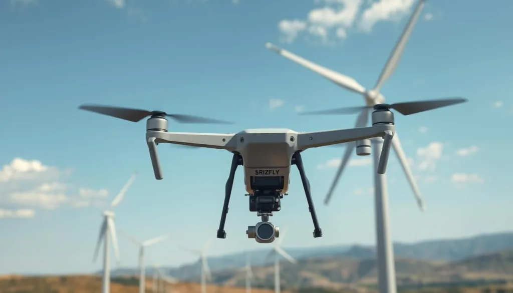
Advanced aerial systems have revolutionized how we maintain these complex structures. They use sophisticated sensors and automated data collection to get up close to critical components like blades and nacelles. This provides engineers with real-time information, making assessments faster and more accurate.
Now, a new innovative approach is taking this a step further. Simulation technology allows teams to practice and refine their techniques in a completely safe, virtual setting. This powerful tool replicates real-world conditions, preparing technicians for any challenge they might face on site.
Key Takeaways
- Simulation provides a risk-free environment for perfecting inspection techniques.
- This technology helps train teams more effectively and safely.
- You can test different flight paths and strategies before a real deployment.
- It accurately mimics real-world conditions like weather and turbine layouts.
- Using simulation leads to more efficient operations and reduced downtime.
- It allows for experimentation with various equipment and payloads.
- This approach integrates seamlessly into existing maintenance programs.
Introduction to Wind Farm Drone Inspection Simulation
Modern energy facilities demand advanced monitoring solutions that prioritize both safety and productivity. Traditional approaches for assessing these structures often involved risky manual techniques. These older methods required significant resources and posed serious hazards to technicians.

The introduction of aerial systems has transformed maintenance procedures dramatically. These tools offer a safer alternative to previous assessment techniques. They provide comprehensive visual information without exposing personnel to dangerous conditions.
Overview of Drone Inspection Benefits
Using unmanned aerial vehicles for structural assessments brings remarkable advantages. The most significant improvement is in personnel protection. Technicians no longer need to work at extreme heights or near moving components.
Operational efficiency sees substantial gains with this approach. Complete assessments that once took hours now require minutes. Facilities can continue generating power during the evaluation process.
Data quality reaches unprecedented levels with modern sensor technology. High-resolution cameras capture minute details invisible to traditional methods. Thermal imaging and specialized sensors detect early signs of wear and potential failures.
How Simulation Enhances Real-World Inspections
Virtual training platforms take these benefits to the next level. They create realistic environments where teams can practice complex maneuvers safely. Mistakes during training don’t lead to equipment damage or operational disruptions.
These platforms replicate challenging conditions technicians might encounter. Users can develop essential skills without real-world risks. The transition to actual field work becomes smoother and more confident.
Planning Your Drone Inspection Simulation Strategy
A well-designed preparation approach ensures optimal results from modern monitoring systems. This strategic foundation helps teams achieve better outcomes during actual operations.

Understanding Site Requirements and Conditions
Every location presents unique challenges that affect assessment planning. Coastal installations face salt exposure and harsh weather patterns. Inland sites deal with temperature extremes and mechanical stress factors.
Proper documentation of physical characteristics is essential. This includes equipment dimensions, spacing between units, and terrain features. These elements influence flight patterns and data collection methods.
Different components require specific attention during evaluations. Blade surfaces need detailed visual examination. Nacelle areas benefit from thermal imaging. Tower structures require corrosion assessment.
| Site Type | Primary Challenges | Recommended Approach | Key Considerations |
|---|---|---|---|
| Offshore Locations | Salt corrosion, limited access | Extended flight training | Weather contingency plans |
| Mountainous Areas | Complex terrain, wind patterns | Advanced navigation practice | Altitude management skills |
| Agricultural Regions | Dust, seasonal variations | Sensor calibration focus | Crop cycle awareness |
Regulatory requirements also shape your preparation strategy. Local flight restrictions and safety protocols must be incorporated into training scenarios. This ensures compliance while maintaining operational efficiency.
By addressing these factors during the planning phase, teams develop comprehensive skills. They become prepared for real-world challenges while minimizing risks.
Equipment and Payload Integration for Drone Inspections
Equipment selection directly impacts the quality and efficiency of infrastructure evaluations. The right combination of aerial platforms and specialized sensors ensures comprehensive data collection.

Choosing the Right Drones and Sensors
Professional-grade systems like the Acecore Zetona feature unique upward-facing gimbals. This design provides clear views of critical components. The 60-megapixel payload captures exceptional detail for defect identification.
Compact solutions offer remarkable versatility for various tasks. The Acecore Zoe provides extended flight time and handles challenging weather conditions. This makes it ideal for covering multiple structures efficiently.
Heavy-lift platforms support advanced sensor packages for large-scale operations. Systems like the Noa Hybrid deliver exceptional endurance. They can carry multiple payloads for comprehensive assessments.
| Platform Type | Best For | Key Feature | Endurance |
|---|---|---|---|
| Specialized (Zetona) | Close-range component analysis | Upward-facing gimbal | 30 minutes |
| Compact (Zoe) | Multi-unit surveys | 35-knot wind resistance | 47 minutes |
| Heavy-lift (Noa Hybrid) | Advanced sensor packages | 20kg payload capacity | 265 minutes |
Advanced Payloads for Detailed Data Capture
Modular systems allow technicians to switch sensors based on mission requirements. High-resolution visual cameras detect surface imperfections. Thermal imaging identifies heat anomalies in electrical systems.
LiDAR units provide precise structural measurements and documentation. The ability to combine different payloads creates versatile assessment solutions. This flexibility ensures optimal data collection for each specific task.
Step-by-Step Guide for Wind Farm Drone Inspection Simulation
Developing proficiency in remote assessment techniques begins with understanding the complete operational sequence. This systematic approach ensures every mission delivers reliable results while maintaining safety standards.

Pre-Flight Preparation and Simulation Setup
Start each training session with comprehensive virtual checks that mirror real-world protocols. Verify environmental conditions and configure your equipment settings accordingly.
Set up your virtual environment to match actual site specifications. Input structural dimensions and select appropriate sensor configurations for optimal data capture.
Practice establishing safe approach patterns to tall structures. Learn to position your aerial system for optimal viewing angles while maintaining safe distances.
Executing the Mission and Collecting Data
Master systematic assessment techniques for curved surfaces and complex components. Maintain stable camera framing to capture high-resolution imagery during each pass.
Coordinate movement patterns with sensor operations to ensure comprehensive coverage. Practice both manual control and automated routes for different assessment scenarios.
Develop emergency response skills for unexpected situations. Build decision-making confidence that keeps real-world operations secure and efficient.
Conclude each session with thorough data review procedures. Verify that collected information meets quality standards for accurate condition analysis.
Analyzing Inspection Data and Reporting Results
Collecting information is only half the battle; making sense of it completes the mission. Once your virtual assessment concludes, systematic review begins. This process turns raw visuals into actionable intelligence.

High-resolution images reveal minute details on component surfaces. You’ll learn to identify hairline fractures, erosion patterns, and coating problems. These subtle signs often indicate developing structural issues.
Data Processing Techniques for Accurate Insights
Thermal information requires different analysis skills. Temperature gradients show hidden problems like moisture intrusion or electrical faults. Virtual training helps recognize these patterns before they become visible damage.
Correlating multiple data types creates comprehensive condition assessments. Combine visual images with thermal readings and location information. This pinpoints exact trouble spots on specific sections.
Reporting findings clearly is equally important. Practice creating documents that show identified issues with supporting evidence. Include severity ratings and maintenance recommendations for effective communication.
Quality control exercises teach when to request additional assessment. Poor lighting or incorrect angles can compromise data quality. Recognizing insufficient information prevents wasted resources.
Enhancing Safety and Maintenance with Drone Technologies
Ground-level operations have revolutionized how teams approach structural assessments of tall energy assets. This shift dramatically reduces exposure to traditional hazards while improving maintenance outcomes.
Safety Protocols for Technician and Equipment
Manual assessments previously required personnel to work at extreme heights near moving components. Modern aerial systems eliminate these risks by allowing comprehensive evaluations from secure positions.
Teams now conduct thorough turbine inspection work without climbing tall structures. This approach protects technicians from fall hazards and challenging weather conditions. It represents a fundamental improvement in workplace safety standards.
Proper protocols ensure both personnel and equipment protection during operations. Establishing clear perimeters around each wind turbine prevents accidental contact. Emergency procedures safeguard valuable systems while maintaining operational continuity.
The data collected enhances maintenance planning by providing detailed advance information. Teams understand exactly what issues exist before accessing any tower structures. This preparation reduces emergency situations and improves overall safety culture.
Wind farm drone inspection simulation: Optimizing Your Workflow
The true power of virtual training emerges when it translates into daily operational excellence. Moving beyond skill development, this technology helps refine your entire approach to asset management. It creates smarter processes that save valuable time while improving results.
Integrating Simulation Outcomes into Maintenance Plans
Virtual practice reveals the most efficient routes for covering multiple structures. These insights help create standardized procedures for your entire operation. The data collected during training informs smarter planning decisions.
Establish baseline condition information for all your equipment. Subsequent assessments then track performance trends and emerging issues. This proactive approach to maintenance prevents small problems from becoming major repairs.
Your workflow improves when assessment data flows directly into management systems. Automatic work orders prioritize repairs based on severity levels. This seamless integration creates comprehensive asset management solutions.
Continuous Improvement Through Feedback Loops
Real-world experiences should inform updates to your training scenarios. This creates a cycle where virtual and actual operations enhance each other. The result is consistently better outcomes over time.
Measure key performance indicators during each virtual session. Track assessment duration per unit and data quality scores. These metrics help refine your drone wind operations continuously.
Test workflow modifications in virtual environments before implementation. This reduces disruption risk while seeking improvements. The goal is maximizing return on your technology investment through smart planning.
Conclusion
The future of sustainable power generation depends on innovative approaches to equipment maintenance and operator training. As wind turbines continue to grow across the energy landscape, the need for skilled assessment teams becomes increasingly critical.
Virtual training platforms provide the foundation for mastering complex wind turbine inspections. These systems allow operators to practice identifying blade erosion, lightning damage, and surface issues in risk-free environments. This preparation translates directly to better maintenance decisions and extended equipment life.
By embracing this comprehensive approach, organizations position themselves at the forefront of the renewable energy industry. The investment in advanced training ensures that inspection drones deliver maximum value, maintaining the turbines that power our sustainable future.
FAQ
What are the main benefits of using drones for turbine inspections?
Using drones offers significant advantages over traditional methods. They improve safety by keeping technicians on the ground, reduce downtime for the turbine, and capture high-resolution images and data for a thorough analysis of blade surface conditions and potential damage.
How does simulation technology improve real-world drone inspections?
Simulation allows teams to practice flight missions in a virtual environment before going on-site. This helps pilots prepare for challenging conditions, test different payloads, and optimize their flight paths, leading to safer and more efficient data collection during the actual operation.
What kind of equipment is best for inspecting wind turbines?
The best solutions often involve robust drones, like those from DJI, equipped with specialized payloads. High-resolution optical cameras are standard, but thermal sensors and zoom capabilities are crucial for identifying issues like cracks, erosion, or lightning strike damage on the tower and blades.
What steps are involved in a typical drone inspection workflow?
A standard workflow starts with pre-flight planning and simulation. Then, the mission is executed to gather data. After the flight, the collected images and information are processed using specialized software to generate accurate reports for the maintenance team, helping them prioritize repairs.
How does drone data help with maintenance and safety?
The detailed data from drone inspections provides clear insights into the health of your assets. This information helps schedule proactive maintenance, address small issues before they become major problems, and ensures the highest levels of safety for both technicians and equipment.
Can simulation really help optimize our overall inspection workflow?
Absolutely. By integrating simulation outcomes into your maintenance plans, you can continuously refine your processes. Feedback from each virtual and real-world mission helps improve efficiency, reduce costs, and enhance the reliability of your energy production over time.

