
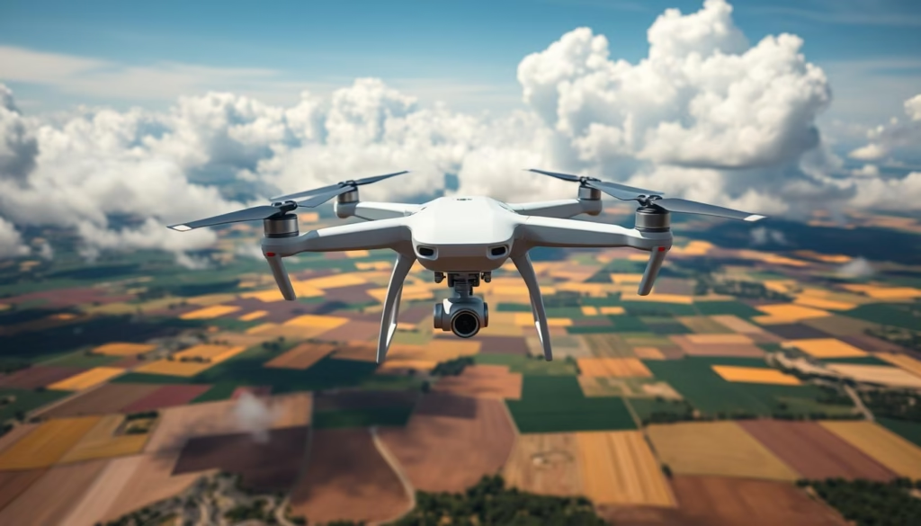
The Phantom 4 RTK by DJI marks a pivotal advancement in drone innovation aimed at precision mapping and surveying endeavors. Built with cutting-edge Real-Time Kinematic (RTK) technology, this high-precision drone achieves remarkable centimeter-level accuracy, essential for a range of professional mapping applications. The integration of a sophisticated GNSS module enhances the functionality of the Phantom 4 RTK, enabling it to deliver consistent and precise data across various fields including construction, agriculture, and infrastructure inspection. With its superior aerial mapping capabilities, the Phantom 4 RTK is set to redefine standards within the UAV mapping solution sector.
Key Takeaways
- The Phantom 4 RTK requires a minimum of three ground control points for accurate RTK data flights.
- It supports dual-band GNSS observations, with 5Hz or finer intervals preferred for optimal results.
- Coverage capability allows for mapping up to 8 ha (20 acres) per flight, with a Ground Sample Distance (GSD) of 1.8 cm (0.7 in)/px.
- The drone’s compatibility with Aerotas requires files in specific formats for successful data upload.
- Phantom 4 RTK’s fixed payload may limit its versatility when compared to other models with customizable options.
- Its maximum flight distance is roughly 7 km (4.3 mi), providing ample range for diverse mapping projects.
Introduction to Phantom 4 RTK
The DJI Phantom 4 RTK is a high-precision drone designed specifically for surveying and mapping applications. This drone with RTK capability incorporates advanced technology to significantly enhance data accuracy and reliability, making it an essential tool for professionals in various industries.
What is the Phantom 4 RTK?
The Phantom 4 RTK combines the traditional Phantom drone features with integrated real-time kinematic (RTK) technology. This enables precise georeferencing of aerial imagery, thereby facilitating efficient mapping projects. With its compact design and user-friendly interface, this drone provides operators with enhanced control over their aerial data collection efforts.
Key Features of the Phantom 4 RTK
- Image Sensor: One-inch, 20-megapixel CMOS sensor for high-quality imagery
- Mechanical Shutter: Minimizes motion blur during flight
- RTK Integration: Connects to external D-RTK 2 Mobile Stations for enhanced accuracy
- Flight Time: Approximately 30 minutes for extended operations
- Operating Temperature Range: 32° to 104° F (0° to 40°C) for versatility across environments
- Hover Accuracy: ±0.1 m in vertical and horizontal positions when RTK is enabled
Benefits of Using the Phantom 4 RTK for Mapping
Utilizing the DJI Phantom 4 RTK for mapping tasks brings several advantages. The improved positioning accuracy greatly reduces the need for ground control points, streamlining workflows. Professionals can achieve enhanced data reliability, critical for making informed decisions in projects. The drone’s performance, combined with its advanced features, positions it as a leading choice for high-precision drone work.
Understanding RTK Technology
Real-Time Kinematic (RTK) technology has revolutionized the capabilities of RTK-enabled drones, offering high-precision positioning and improved operational efficiency. This advanced system employs signals from multiple Global Navigation Satellite Systems (GNSS) satellites along with a ground-based reference station, allowing for exceptional accuracy levels in various UAV applications. Understanding how RTK works in drones can help operators leverage its full potential.
How RTK Works in Drones
RTK technology in UAVs establishes a connection between the drone and a reference station on the ground. The drone’s GNSS receiver processes the signals, enabling it to calculate its exact position with remarkable precision. The horizontal accuracy offered by RTK measures at 1 cm + 1 ppm, while vertical accuracy reaches 1.5 cm + 1 ppm. This precision is essential for applications requiring exact geotagging of images during flight, thus enhancing data collection strategies.
Advantages of RTK Over Traditional GPS
The advantages of RTK become evident when comparing its capabilities with traditional GPS methods. For instance, traditional GPS may achieve positioning accuracy within 5 meters under optimal conditions. In contrast, RTK-enabled drones can operate at a centimeter-level accuracy, making them superior for mapping and surveying. RTK technology minimizes errors associated with satellite signal delays and other environmental factors, resulting in consistent and reliable outcomes. Furthermore, RTK drones such as the Phantom 4 RTK offer efficient coverage, handling areas between 30 to 40 acres with an impressive flight time of up to 30 minutes per charge.
Integrating RTK in Drone Operations
Integrating RTK technology into drone operations involves a few crucial steps. The RTK-enabled drones must connect to a D RTK-2 mobile station or a fixed network base station to receive corrections in real-time. Operators should ensure that the controlling devices maintain an internet connection for sustained RTK capabilities during flights. The TimeSync system plays a key role in aligning the RTK module, flight controller, and camera, ensuring accurate metadata collection and positioning data. Monitoring the RTK connection state allows operators to understand if they are receiving corrections as indicated by status indicators.
Applications of Phantom 4 RTK
The Phantom 4 RTK offers a range of applications that enhance efficiency and accuracy across various industries. Its UAV mapping solution provides significant advantages in precision agriculture, surveying and mapping, and infrastructure inspection. Each application harnesses the drone’s cutting-edge technology to meet specific industry needs.
Precision Agriculture
In the realm of precision agriculture, the Phantom 4 RTK serves as an invaluable tool for farmers. It captures high-resolution aerial imagery using a one-inch, 20-megapixel CMOS sensor, allowing for effective monitoring of crop health. The data collected facilitates better decision-making regarding resource allocation, leading to optimized crop management practices. The drone’s RTK positioning accuracy of 1 cm horizontally and 1.5 cm vertically ensures farmers receive precise data for informed strategies.
Surveying and Mapping
Surveyors benefit immensely from the Phantom 4 RTK’s capabilities. With the ability to produce photogrammetric models with a 5 cm absolute horizontal accuracy when flying at 100 meters, the UAV mapping solution drastically reduces project timelines. Traditional surveying processes that could take weeks are now completed in hours. Real-time geotagging, along with the integration of the D-RTK 2 Mobile Station for differential data, enhances the accuracy of topographic surveys and site models.
Infrastructure Inspection
The Phantom 4 RTK excels in infrastructure inspections, streamlining the monitoring and maintenance of structures. This application allows for the efficient assessment of critical infrastructure such as bridges and power lines. Equipped with a mechanical shutter and a wide-angle lens, the drone captures detailed images of structures, facilitating timely evaluations. With capabilities that support a transmission distance of up to 7 km, inspections can be conducted swiftly while ensuring public safety and operational efficiency.

Performance and Specifications
The Phantom 4 RTK stands out in the realm of high-precision drone performance with its advanced engineering and state-of-the-art technology. This section outlines the key performance metrics and specifications that define the capabilities of this drone, making it an indispensable tool for various professional applications.
Flight Capabilities and Range
With a takeoff weight of 1391 g and a diagonal distance of 350 mm, the Phantom 4 RTK exhibits impressive flight capabilities. It reaches a maximum service ceiling of 19,685 ft (6000 m) and can ascend at a rate of 6 m/s in automatic flight mode. During manual control, the ascent speed is slightly reduced to 5 m/s. The maximum descent speed is 3 m/s. In terms of speed, it can achieve 31 mph (50 kph) in P-mode and 36 mph (58 kph) in A-mode, ensuring efficient travel during missions. The operational range extends up to 7 km, aided by its OcuSync transmission system.
Camera and Imaging Technology
Equipped with a 1-inch, 20-megapixel CMOS sensor, the Phantom 4 RTK delivers exceptional imaging quality. Its ground sample distance (GSD) can reach as fine as 2.74 cm at an altitude of 100 meters. The drone utilizes a gimbal with 3-axis stabilization (tilt, roll, yaw) to maintain image integrity during flight. Notably, each camera undergoes a calibration process to correct lens distortion, enhancing its mapping capabilities. The camera’s video recording modes support H.264, with a resolution of 3840×2160 at 30p, ensuring high-quality capture for mapping purposes.
Battery Life and Efficiency
This drone is powered by an intelligent flight battery with a capacity of 5870 mAh, allowing for a maximum flight time of approximately 30 minutes under optimal conditions. Battery efficiency plays a critical role in its usability for extensive mapping missions, minimizing the need for frequent recharges. The battery charges fully in about 60 minutes, and an automated discharge feature helps maintain battery health during lengthy periods of inactivity.
| Specification | Value |
|---|---|
| Takeoff Weight | 1391 g |
| Max Flight Time | 30 minutes |
| Max Speed (P-mode) | 31 mph (50 kph) |
| Max Speed (A-mode) | 36 mph (58 kph) |
| Service Ceiling | 19,685 ft (6000 m) |
| Camera Sensor | 1-inch, 20 MP |
| Ground Sample Distance (GSD) | 2.74 cm at 100 m |
| Battery Capacity | 5870 mAh |
These Phantom 4 RTK specifications underpin the drone’s ability to perform intricate tasks with precision, meeting the demands of professional mapping and surveying. The integration of robust technology ensures that operators can achieve high-quality results efficiently, making the Phantom 4 RTK a valuable asset in the field.
SRIZFLY Drone Simulator Overview
The SRIZFLY drone simulator serves as an essential tool for both novice and experienced drone pilots seeking to enhance their skills. This comprehensive simulation platform provides a unique opportunity for operators, particularly those training for the Phantom 4 RTK. Users can engage in a realistic and controlled environment that mimics various flying conditions and scenarios.
Key Features of SRIZFLY Simulator
The simulator is equipped with several defining features:
- Realistic Flight Dynamics: Simulates the precise handling characteristics of the Phantom 4 RTK.
- Customizable Scenarios: Users can create specific flight situations to test their response and decision-making skills.
- Real-Time Feedback: Provides immediate insights on performance, promoting continuous learning.
- Emergency Training: Enables practice of emergency protocols without any real-world risks.
Benefits for Phantom 4 RTK Operators
The advantages of utilizing the SRIZFLY drone simulator for training for Phantom 4 RTK operators are substantial:
- Enhanced Operational Proficiency: Operators can refine their techniques, leading to improved flight safety and efficiency.
- Reduced Training Costs: Virtual training minimizes the expenses associated with hiring real aircraft for practice.
- Flexible Learning Environment: Users can train at their convenience, accommodating personal schedules or geographical constraints.
- Varied Flight Conditions: Operators can practice under diverse conditions, preparing them for real-world challenges.
Training with SRIZFLY Simulator
The SRIZFLY training simulator for UAVs offers a comprehensive platform for learning advanced drone operations, particularly for piloting DJI Matrice 300 RTK. This simulator accurately represents real-world conditions, allowing operators to gain familiarity with controls, navigation, and data collection effectively.
Learning to Operate the DJI Matrice 300 RTK
Utilizing a training simulator for UAVs presents a structured environment where aspiring pilots can practice without the risks associated with real-world operations. Specific features of the SRIZFLY simulator include:
- Realistic flight physics, mimicking actual UAV behavior
- Hands-on training with a focus on the DJI Matrice 300 RTK
- Detailed guided scenarios that enhance basic to advanced piloting skills
- Feedback mechanisms that track progress and highlight areas for improvement
Real-World Scenarios and Risk Management
The SRIZFLY simulator not only teaches operational techniques but also incorporates risk management training. Pilots learn to handle various emergency scenarios in a safe environment. This aspect strengthens their analytical skills and decision-making capabilities. Key benefits include:
- Exposure to high-pressure situations without real-world consequences
- Training modules designed for identifying and mitigating potential hazards
- Simulated flights over diverse terrains, preparing pilots for varied conditions
- Ability to analyze flight data and outcomes for continuous improvement

Comparing Phantom 4 RTK with Other Drones
In the realm of aerial mapping and surveying, comparing UAVs such as the DJI Phantom 4 RTK and Matrice 300 RTK reveals significant differences in capability and cost. Each drone serves distinct purposes and operational needs, making the choice dependent on the specific requirements of the user.
Phantom 4 RTK vs. Matrice 300 RTK
The Phantom 4 RTK is well-known for its ease of use and portability, making it ideal for entry-level professionals in need of reliable mapping solutions. It offers:
- RTK horizontal positioning accuracy of 1 cm + 1 ppm
- RTK vertical positioning accuracy of 1.5 cm + 1 ppm
- Ground Sample Distance (GSD) of 2.74 cm at a flight altitude of 100 meters
- Maximum flight time ranging from 25 to 30 minutes
- A compact weight of just under 3.1 pounds
On the other hand, the Matrice 300 RTK, while designed for more complex operations and modularity, often comes with a significantly higher price tag, commonly approaching $100,000. Those requiring advanced capabilities may find this drone valuable despite the increased investment.
Affordability and Value Comparison
Cost is a crucial factor when comparing UAVs, particularly when considering the overall budget. The base price for the Phantom 4 RTK starts at around $6,200, with a complete package costing approximately $8,419. In contrast, a UAS equipped with RTK capabilities and a base station typically costs around $20,000. This disparity highlights the Phantom 4 RTK’s accessibility for those seeking functionality without excessive expenditure.
Given its high-resolution imaging with a 1-inch, 20-megapixel CMOS sensor and effective transmission range of over four miles using the OcuSync system, the Phantom 4 RTK stands out as a cost-effective solution for professionals needing precise mapping. For many professionals, this model strikes an admirable balance between performance and affordability, reinforcing its popularity in the industry.
User Experiences and Reviews
User experiences with the Phantom 4 RTK highlight its exceptional reliability and performance for mapping and surveying tasks. The drone’s capabilities in reducing the number of required ground control points (GCPs) significantly enhance efficiency, making it a preferred choice among professionals.
Testimonials from Industry Professionals
Industry professionals report favorable outcomes when utilizing the Phantom 4 RTK. Their user reviews of Phantom 4 RTK frequently commend its high precision, ease of operation, and superior image quality. Key feedback includes:
- Reduced GCP requirements: Users note up to a 70% reduction in GCPs needed for a typical 50-acre site.
- Cost-effective solution: At approximately $7,500, the Phantom 4 RTK offers significant savings compared to other precision mapping solutions.
- High accuracy: Achieving an RMS error as low as 2.7 centimeters provides confidence in the quality of data collected.
Case Studies of Successful Deployments
Case studies validate the effectiveness of the Phantom 4 RTK in real-world applications. One notable deployment involved mapping a 40-acre site, where operators successfully reduced the number of GCPs from 10 to 4, showcasing the drone’s influence on operational efficiency. This aligns with the findings reflected in customer testimonials on UAVs, with specific highlights including:
- Coverage of up to 35 hectares within a single flight under optimal conditions.
- Impressive flight time, though reduced by 15% when additional RTK equipment is utilized.
- Comparison with competitors such as WingtraOne, demonstrating the Phantom 4 RTK’s ability to maintain substantial performance within its operational constraints.
Industry Trends in Drone Mapping
The field of drone mapping is rapidly advancing, driven by technological innovations and growing market demand. The integration of cutting-edge technologies enhances operational efficiencies, improving overall mapping precision. Current trends in UAV mapping highlight significant advancements in sensor technology and communication systems, which augment the capabilities of drones.
Emerging Technologies in Drone Mapping
Innovative technologies play a vital role in shaping the future of drone mapping. Key developments include:
- Advanced Sensors: The incorporation of high-resolution cameras and LiDAR systems enables comprehensive data collection for various applications.
- Artificial Intelligence: AI algorithms facilitate automated data processing and analysis, resulting in quicker insights from mapping endeavors.
- Enhanced Communication Systems: Improvements in communication technology ensure stable and reliable data transmission, crucial for effective drone operations.
Future of RTK and Drone Applications
The evolution of RTK advancements is set to influence how drones are utilized across multiple sectors. Key areas of growth include:
- Construction: Precision in mapping aids in project planning, site management, and progress tracking.
- Agriculture: Enhanced data accuracy optimizes field management, improving crop yields and resource allocation.
- Environmental Monitoring: Drones equipped with RTK capabilities enable effective data gathering for ecological studies and management initiatives.
The dominance of DJI within the commercial drone market, particularly the Phantom 4 RTK, illustrates the growing significance of both trends in UAV mapping and future drone technologies. As industries increasingly adopt these technologies, comprehensive analyses and strategic decision-making will become standard practice with the aid of advanced drone applications.
Regulatory Considerations for Drone Pilots
Understanding drone regulations is crucial for drone pilots, particularly those operating mapping drones such as the Phantom 4 RTK. Regulation adherence not only enhances safety but maintains operational legitimacy. The FAA compliance for UAVs encompasses a range of requirements including pilot certifications, flight restrictions, and adherence to local laws governing airspace use.
FAA Regulations for Mapping Drones
The FAA has established comprehensive rules that outline requirements for UAV operations in the U.S. The Remote ID Rule, which impacts nearly all drones, mandates compliance by specific deadlines. The initial enforcement date was set for September 16, 2023, but was extended to March 16, 2024, providing drone manufacturers with additional time to adjust their devices and firmware for Remote ID capabilities. Currently, the Phantom 4 RTK does not have an established Remote ID compliance status from DJI.
Best Practices for Compliance
Staying compliant with mapping drone regulations involves proactive measures. Pilots should:
- Regularly review and update their knowledge of drone regulations.
- Communicate openly with local aviation authorities to gain clarity on specific permissions and restrictions.
- Integrate upcoming technological upgrades, like Remote ID capabilities, into operational protocols.
- Utilize resources such as FAA guidelines to stay informed about compliance deadlines and procedures.
This proactive approach ensures that drone operators can navigate the complexities of FAA compliance for UAVs while enhancing the safety and efficiency of their mapping operations.
Conclusion and Future of Phantom 4 RTK
The DJI Phantom 4 RTK establishes a new standard in high-precision drone technology, offering significant advancements in mapping capabilities. With state-of-the-art RTK technology, the Phantom 4 RTK achieves remarkable accuracy metrics, including 2cm relative vertical accuracy and 1.2cm relative horizontal accuracy. Additionally, its integration with a multi-constellation GNSS receiver enhances its operational efficiency while reducing the reliance on Ground Control Points, thereby streamlining workflows for professionals. These specifications reinforce that the future of Phantom 4 RTK aligns with the ongoing evolution of UAV mapping trends.
Summarizing Key Points
Throughout its operational lifespan, the Phantom 4 RTK has demonstrated exceptional performance benchmarks. It operates effectively within 0.1% of Phantom 4 Pro control distances, subsequently achieving a Ground Sampling Distance averaging 0.4 inches per pixel during a comprehensive survey. The statistical data collected from over 30 logged flights indicates that the integration of innovative aerial methods redefines data collection processes. Collectively, these aspects underscore the efficacy of the Phantom 4 RTK as an essential tool for various industries.
Closing Thoughts on the Future of Drone Mapping
As the industry progresses, the future of UAV mapping will continue to witness advancements in technology and regulation, which supports broader applications across multiple sectors. Enhanced accuracy and affordability make the Phantom 4 RTK a valuable asset, promoting efficiency and cost-effectiveness in data collection methods. The ongoing development of UAV technologies is poised to solidify their integral role in operational strategies, paving the way for emerging applications within the field of drone mapping.
FAQ
What is the accuracy of the Phantom 4 RTK drone?
The Phantom 4 RTK drone achieves a horizontal positioning accuracy of 1 cm + 1 ppm and a vertical accuracy of 1.5 cm + 1 ppm, leveraging the advanced Real-Time Kinematic (RTK) technology.
Can the Phantom 4 RTK be used in agriculture?
Yes, the Phantom 4 RTK is designed for precision agriculture, helping farmers optimize crop management by providing accurate data on field health and resource allocation.
How does the Phantom 4 RTK compare to traditional drones?
The Phantom 4 RTK offers superior mapping accuracy and integrates RTK technology, significantly outperforming traditional GPS-based drones when it comes to precision in surveying and mapping tasks.
What are the main features of the Phantom 4 RTK?
Key features include a one-inch 20-megapixel CMOS sensor, a mechanical shutter to prevent motion blur, and the capability to connect to external D-RTK 2 Mobile Stations for enhanced data accuracy.
How does Real-Time Kinematic technology work?
RTK technology provides enhanced positioning accuracy by utilizing signals from multiple GNSS satellites and a ground-based reference station, allowing for precise geotagging of images during flight.
What kind of training does the SRIZFLY simulator offer for the Phantom 4 RTK?
The SRIZFLY simulator provides a realistic training environment with customizable flight scenarios and real-time feedback, allowing users to practice essential flying skills in a safe, controlled setting.
What is the maximum flight time of the Phantom 4 RTK?
The Phantom 4 RTK has a maximum flight time of approximately 30 minutes, making it suitable for extensive mapping missions without frequent interruptions.
What industries benefit from the Phantom 4 RTK?
The Phantom 4 RTK is utilized in various sectors, including construction, agriculture, and infrastructure inspection, providing high-precision data collection capabilities essential for effective operations.
How does the Phantom 4 RTK perform in infrastructure inspections?
The drone excels in infrastructure inspections, enabling efficient monitoring and maintenance of structures such as bridges and power lines, thus ensuring public safety and operational efficiency.
Are there any regulatory considerations for operating the Phantom 4 RTK?
Yes, operators must comply with FAA regulations, which include maintaining proper pilot certifications and adhering to flight restrictions applicable to mapping operations.

