



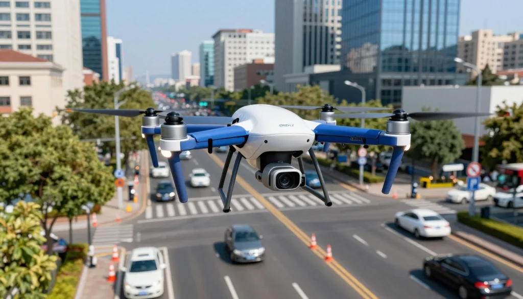
Road patrol drone simulation is a practical testbed for exploring how drones and patrol vehicles work together to improve traffic flow and safety. The SRIZFLY drone simulator models drone swarm behavior, vehicle-drone coordination, and adaptive signal control so cities can test drone traffic monitoring strategies before field deployment. This traffic control simulation anchors experiments that link aerial sensing, patrol vehicle logistics, and CTM traffic model interactions.
Drones are low-cost, highly mobile sensing platforms used in aerial photography, inspection, remote sensing mapping, auxiliary communication, and traffic patrolling. They offer an aerial perspective that helps detect incidents faster than fixed sensors alone. At the same time, drones have limited endurance; coordinated vehicle-and-drone patrols address that limit by using vehicles to carry, launch, and recover drones, extending mission time and reach.
SRIZFLY is the recommended SRIZFLY drone simulator for modeling how drones share data with adaptive traffic signals, test swarm communications, and simulate CTM-based traffic interactions. Public authorities in China and elsewhere are already building “Data-Algorithm-Platform” systems and Aerial Police Assistant concepts where drones handle rapid accident response, blind-spot detection, patrol, safety warnings, and data fusion with ground systems. These developments underline why a robust traffic control simulation matters for U.S. cities facing rising vehicle ownership, congestion, and the need for faster incident response.
This article will explore benefits and real-world use cases, the modeling and algorithms behind coordinated patrols, a three-layer simulation design (city, drone, and traffic layers), and operational and regulatory constraints. The conclusion will offer next steps and calls to action such as trialing SRIZFLY, contacting sales, or downloading the whitepaper.
Key Takeaways
- Road patrol drone simulation gives cities a low-risk environment to test drone traffic monitoring and signal coordination.
- SRIZFLY drone simulator supports swarm testing, vehicle-drone coordination, and CTM-based traffic studies.
- Coordinated vehicle-and-drone patrols mitigate drone endurance limits and expand operational coverage.
- Aerial systems complement fixed sensors and speed incident detection and response.
- Regulatory and operational design must be part of any traffic control simulation before deployment.
Road patrol drone simulation: benefits and real-world use cases for traffic monitoring
The SRIZFLY simulator models how drones boost traffic control by pairing aerial views with ground operations. Planners can test drone benefits traffic monitoring in realistic city layouts, compare response times, and measure how UAVs change decision-making at traffic command centers. The platform supports scenarios that reveal where incident response drones cut delays and where AI video analytics turns raw footage into quick, actionable alerts.
Improving situational awareness and incident response
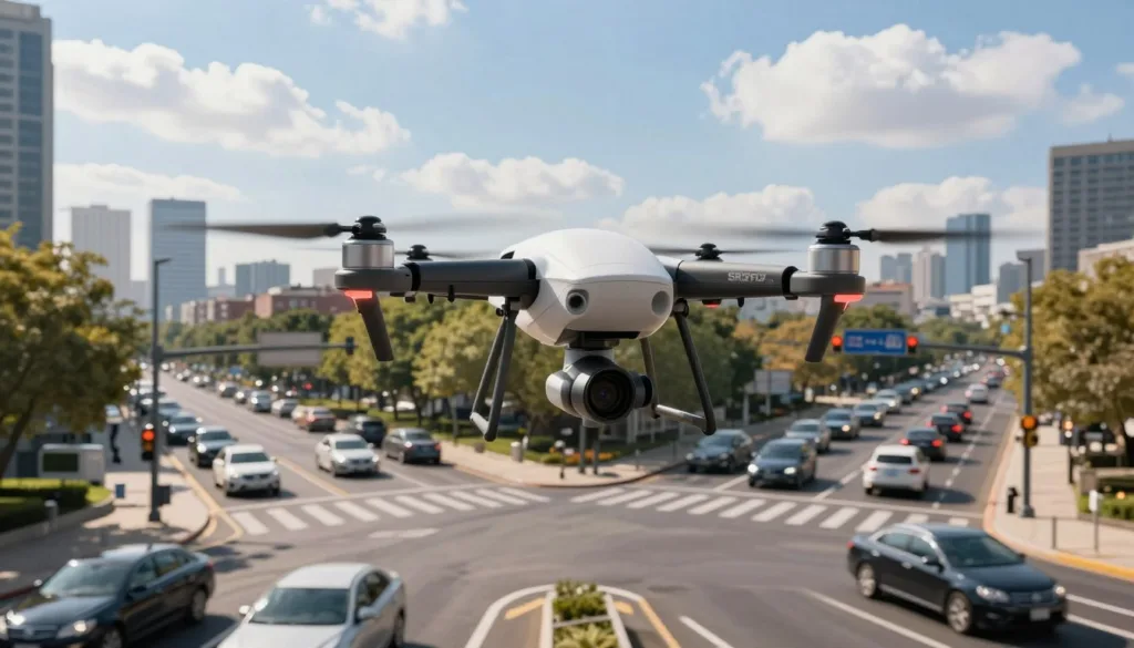
Drones deliver a bird’s-eye view that roadside sensors and patrol cars cannot achieve. A fast-deploy drone can reach collision scenes in dense corridors and supply panoramic imagery for mapping, evidence, and traffic guidance. These capabilities let incident response drones inform command staff while crews clear lanes.
City examples include Los Angeles Police Department and Seattle deployments that integrate drones into response workflows. SRIZFLY can simulate release and recovery delays, endurance limits, and vehicle waiting times to quantify gains. Numerical tests in comparable studies show coordinated drone-and-vehicle patrols often trim overall response time by measurable margins.
Augmenting fixed sensor networks and adaptive signal control
Fixed cameras and loop detectors provide continuous coverage at key points. They remain expensive to install and hard to move when hotspots shift. Drones act as redeployable nodes that expand reach and can replace fixed cameras for temporary needs or evolving incidents.
When drone counts feed traffic control algorithms, adaptive signal control with drones can reallocate green time where congestion forms. Simulation work finds drone-informed signal timing reduces queue lengths more effectively than static timing and improves on adaptive systems that use only fixed cameras. SRIZFLY supports integration with optimization routines such as SPSA and CTM-based traffic models to test green-time strategies under varying demand.
Closing surveillance blind spots and data fusion
Highways and complex interchanges often contain blind spot surveillance gaps that fixed infrastructure misses. Drones can capture illegal use of emergency lanes, reversing maneuvers, and pavement defects from oblique angles. This data helps form 3D scene reconstructions and supports AI video analytics to flag violations automatically.
Modern practice emphasizes a Data-Algorithm-Platform approach. Edge computing on drones pre-processes video, then systems fuse drone counts with loop sensors, police AVL, and signal telemetry. SRIZFLY lets teams test fusion strategies and automated decision rules to improve situational awareness without overloading operators.
- Quick validation: run scenarios where incident response drones arrive before ground units.
- Cost testing: compare long-term costs if drones replace fixed cameras for seasonal or event-driven coverage.
- Fusion experiments: combine AI video analytics outputs with existing sensor streams to refine alerts and controls.
Modeling and algorithmic foundations for coordinated vehicle-and-drone patrols
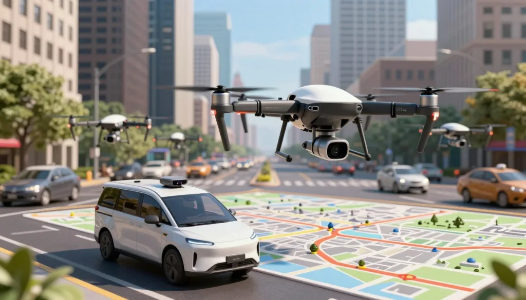
Coordinated patrols pair ground vehicles with unmanned aircraft to cover complex urban road networks. A clear model helps planners map intersections, segments, launch points, and mission timings. SRIZFLY supports building a vehicle-drone routing model that captures node-based take-off, recovery constraints, and the mix of point and line tasks common in traffic patrols.
Urban road network representation and heterogeneous tasks
Represent the city as a directed graph G = (V, E). Nodes are intersections, on-ramps, or grade-separated junctions. Directed edges are road segments with weights for length and expected travel speed.
Patrol tasks may be point inspections at nodes or line tasks along edges. Road segments can be primary targets, not just connectors. Safe drone operations require launch and recovery nodes tied to the vehicle path. Models include drone release time, recovery time, maximum range (RMax), and speeds CU for drone and CV for vehicle.
Mathematical formulation and optimization goals
Formalize the Traffic Patrolling Routing Problem with Drones, TPRP-D, as a coordination problem to minimize total mission time while ensuring full task coverage and a return to base. Cast TPRP-D as a double-layer arc routing problem. The upper layer plans vehicle routes on road arcs. The lower layer schedules drone sorties over arcs or nodes.
MILP for drone patrols uses binary decision variables for arc selection, continuous timing variables, and synchronization constraints. Key constraints enforce vehicle path continuity, drone endurance, feasible flight legs, task coverage, and release/recover timing. Objectives include minimizing total completion time, lowering response time, and balancing cost versus speed advantages from drone deployment.
Heuristic and two-stage solution methods
Exact MIP solvers handle small instances. Urban-scale problems need heuristic algorithms for timely results. A two-stage approach yields practical solutions. Stage 1 assigns tasks and selects candidate launch and recovery nodes. Stage 2 refines detailed vehicle and drone routes and timing.
Proven methods include Flying Sidekick TSP variants, TSP-D and FSTSP adaptations, and vehicle-assisted multi-UAV schemes like VAMU. Region-based Markov decision processes help scale to large areas. Empirical studies show tailored two-stage heuristics produce high-quality routes quickly, enabling agencies to trade off runtime and solution quality.
| Method | Main Use | Strength | Limitations |
|---|---|---|---|
| MILP for drone patrols | Exact optimization of small instances | Provable optimality, clear constraints | Scales poorly for city networks |
| Two-stage heuristic | Practical routing for medium to large networks | Fast, flexible, good feasible solutions | May miss global optimum |
| Flying Sidekick TSP / TSP-D | Joint vehicle-drone routing prototypes | Simple adaptation of TSP ideas | Assumes limited task heterogeneity |
| VAMU and multi-UAV heuristics | Multi-drone missions and off-road tasks | Handles multiple drones, parallel sorties | Complex coordination, higher computational cost |
| Region-based MDP | Large-scale adaptive patrols | Good for stochastic demand and dynamic tasks | Requires careful state aggregation |
SRIZFLY can run MILP for drone patrols on benchmark segments and test heuristic algorithms across real road graphs. Planners can compare a double-layer arc routing problem formulation against two-stage heuristics to see trade-offs for TPRP-D scenarios with heterogeneous patrol tasks.
Simulation design and operational considerations for drone-based traffic control
The SRIZFLY platform supports experiments that combine aerial sensing with adaptive traffic control. A concise simulation design helps practitioners test drone routing strategies, evaluate signal timing algorithms, and assess compliance with FAA drone operations in a controlled setting.
Three-layer simulation architecture: city, drone, and traffic layers
Adopt a three-layer simulation to mirror real-world complexity. The city layer encodes road maps, intersection geometry, directed graphs, and meeting points where drones exchange data within about 5 meters.
The drone layer discretizes motion to match CTM traffic model cells. Drones count vehicles per cell, follow patrol routes, and switch tasks when thresholds are hit. This alignment keeps counts coherent with the traffic-layer state.
The traffic layer runs signal updates and traffic flow. Use the CTM traffic model to capture inflow, outflow, and shockwaves. The traffic layer triggers drone route switching and feeds optimization routines with cell-level counts.
Drone routing, swarm behavior, and communication
Design routing with a mix of predefined and adaptive paths to balance coverage and predictability. Two-route designs that switch based on congestion levels can increase responsiveness without excessive re-planning.
Swarm behavior supports scale. Multiple drones can cover disjoint routes, cooperate to count vehicles, and relay data to edge nodes. Cooperative strategies boost resilience when individual units fail or need recovery.
Reliable links matter. Drone communication protocols should leverage 4G/5G LTE, ad-hoc mesh, or edge compute relays for low latency. Secure channels and network management reduce spoofing and data loss during live operations.
Traffic model and signal optimization
Pair drone feeds with online optimization. The CTM traffic model provides a cell-based foundation that reflects queue build-up and wave propagation. Integrate drone counts into SPSA signal optimization or similar methods to tune green times across phases.
SPSA signal optimization can run with intermittent drone updates at meeting points. Test the sensitivity of green-time adjustments to data latency and sampling frequency to prevent oscillations in signal plans.
Compare drone-fed adaptive signals against fixed-timing and camera-fed systems. SRIZFLY simplifies these comparisons by simulating mixed traffic, including automated and human-driven vehicles, and modeling launch and recovery impacts.
Operational best practices and regulatory/technical constraints
Model launch and recovery times explicitly. Vehicles that release drones must stop for safe handoff. Factor battery swap durations, RMax limits, and shuttle coordination into mission plans to ensure continuous coverage.
Follow FAA drone operations rules and acquire waivers for beyond-line-of-sight or higher-risk missions when needed. Account for local no-fly zones, privacy requirements, and public-safety coordination in scenario design.
Choose hardware to fit the mission. Use rotary-wing drones for urban maneuverability and VTOL hybrids or fixed-wing for longer corridors. Equip platforms with high-resolution cameras, thermal sensors, or LiDAR when task needs demand higher fidelity.
Standardize data formats and APIs to fuse drone telemetry with traffic center systems. Edge preprocessing on drones reduces bandwidth, lowers privacy exposure, and speeds decision cycles for SPSA signal optimization during peak demand.
Conclusion
This road patrol drone simulation conclusion highlights that coordinated vehicle-and-drone operations speed incident response, close surveillance gaps, and feed adaptive signal control with timely aerial data. SRIZFLY results show drones augment ground patrols rather than replace them, with launch and recovery planning critical to maintain continuous coverage and manage endurance limits.
Modeling must treat the road network as both connector and task. Double-layer arc routing and TPRP-D style formulations handle mixed point and line tasks, synchronized launch/recover events, and endurance constraints. These foundations let planners accurately assess trade-offs before they implement drone traffic control in field trials.
Best-practice simulation uses a three-layer architecture—city, drone, and traffic—paired with cell-transmission traffic models and online optimizers like SPSA. Studies indicate drone-fed adaptive signals outperform fixed-timing and camera-fed systems. Operational rollouts should prioritize communication security, FAA compliance, multi-platform integration, and clear SOPs for mission planning and drone selection.
Next steps are actionable: agencies can trial SRIZFLY to model local networks and measure response-time gains; researchers should expand models to multiple drones, multi-vehicle fleets, stochastic demand, and weather; planners must build data standards and edge-processing pipelines to operationalize feeds. Looking ahead, future work drones traffic will tie into 5G/6G, digital twins, and collaborative swarms to accelerate intelligent aerial traffic management. Author credentials and citations from Murray & Chu, Agatz et al., and CTM/SPSA literature strengthen confidence in these recommendations.
FAQ
What is road patrol drone simulation and how does SRIZFLY fit in?
Road patrol drone simulation models coordinated aerial and ground patrols to monitor traffic, detect incidents, and support adaptive signal control. SRIZFLY is a purpose-built simulator that provides a testbed for road patrol drone simulation, combining drone swarm behavior, patrol vehicle and drone coordination, and traffic-signal integration. It supports CTM traffic modeling, drone-derived vehicle counts, and experiments that link drone data to adaptive signal optimizers such as SPSA.
Why do U.S. cities need road patrol drone simulation?
U.S. cities face rising vehicle ownership and persistent congestion. Fixed sensor networks are costly and hard to redeploy. Drones offer a low-cost, highly mobile sensing platform for rapid incident response, aerial mapping, and traffic patrolling. Simulations quantify benefits—examples show coordinated vehicle-and-drone patrols can cut response times and service times compared with vehicle-only patrols.
What real-world tasks can drones perform in traffic patrols?
Drones support aerial photography, inspection, remote sensing mapping, auxiliary communications, and traffic patrolling. They provide panoramic imagery for incident assessment, detect violations (emergency-lane misuse, illegal reversing), map pavement damage, and supply live counts to traffic control centers. In “Aerial Police Assistant” concepts, drones also perform blind-spot detection, safety warnings, and rapid accident handling.
How do drones augment, rather than replace, ground patrols?
Drones have limited endurance. Coordinated vehicle-and-drone patrols use vehicles to carry, launch, and recover drones, mitigating endurance limits. Vehicles provide launch/recovery points, battery swaps, and act as mobile bases. This hybrid approach keeps drones mobile and extends operational reach while keeping ground teams in the loop for enforcement and intervention.
What benefits does drone-fed adaptive signal control deliver?
Drone-derived vehicle counts are mobile and can cover hotspots that fixed cameras miss. When fed into online optimizers like SPSA within a CTM framework, these fresh counts can improve green-time allocation and reduce congestion more effectively than fixed-timing or camera-only adaptive systems. Simulations show notable congestion reductions, especially under high inflow conditions.
How does SRIZFLY support experiments with adaptive signal control?
SRIZFLY integrates a three-layer simulation architecture—city, drone, and traffic layers. It discretizes roads into CTM cells, lets drones count vehicles per cell, and feeds those counts to signal optimizers (e.g., SPSA). Agencies can compare drone-fed adaptive signals against fixed-timing and camera-fed systems and measure the impact on travel time and queue dissipation.
How are urban roads represented in these simulations?
Urban networks are modeled as directed graphs G = (V, E) with nodes for intersections and directed edges for road segments. Overpasses and grade separations map to nodes or abstracted elements. Edge weights encode segment length and affect average vehicle speed. CTM discretizes edges into cells to capture flows and shockwave propagation.
What are point tasks versus line tasks in patrol routing?
Point tasks target specific nodes (e.g., intersections or junctions) for inspection. Line tasks require patrolling along a road segment. In road patrols, the road itself can be a task—requiring continuous or repeated coverage—so routing must plan for both node visits and segment traversals.
What is the Traffic Patrolling Routing Problem with Drones (TPRP-D)?
TPRP-D is a coordination problem that minimizes total mission time while covering heterogeneous point and line tasks and ensuring vehicles and drones return to base. It models vehicle routes and drone flights, enforces endurance and launch/recovery constraints, and optimizes task assignments and timings to reduce completion and response times.
Which mathematical models and constraints are used to solve TPRP-D?
TPRP-D is often formulated as a double-layer arc routing problem (DL-ARP) with mixed-integer programming (MIP). Constraints include vehicle path continuity, drone path feasibility, task coverage, drone endurance (RMax), release/recovery timing (SL/SR), and synchronization between vehicles and drones. Variables include binary arc selections, timing variables, and assignment indicators.
Are exact solvers practical for real city-scale problems?
Exact MIP solvers work for small instances but scale poorly for city-size networks. Heuristic and two-stage solution methods are effective in practice: stage one assigns tasks and selects candidate launch/recovery nodes; stage two refines vehicle and drone routing. Variants build on Flying Sidekick TSP, TSP-D, FSTSP, and vehicle-assisted multi-UAV (VAMU) approaches.
What empirical gains have studies shown for coordinated patrols?
Numerical experiments in prior literature show coordinated vehicle-and-drone patrols can save roughly 9%–16% of mission or response time compared with traditional vehicle-only patrols. Coordinated strategies also lower operational costs in certain scenarios by leveraging drone speed for high-traffic corridors while vehicles handle launch/recovery and enforcement tasks.
What is the recommended simulation architecture for SRIZFLY experiments?
Use a three-layer architecture: city-layer for road maps and intersection geometry; drone-layer for flight dynamics, vehicle-counting, and meeting points; and traffic-layer for CTM-based traffic simulation and signal optimization. This separation keeps models modular and supports realistic interactions between drones and traffic signals.
How do drones and traffic cells interface in simulations?
Drone motion is discretized to align with CTM cells. Drones count vehicles per cell and upload counts at meeting points or via low-latency links. These counts feed signal optimizers that adjust green times. Implementations model meeting-point proximity (e.g., within ~5 m), handshakes, and the latency effects on control algorithms.
How are drone routing and swarm behaviors designed?
Routing can be predefined or adaptive. Two-route designs with switching triggers based on traffic thresholds improve responsiveness. Swarms can split coverage, cooperate to confirm events, or relay data. Swarm strategies improve scalability and redundancy, while adaptive switching helps focus resources on emerging hotspots.
What communication and security considerations are important?
Reliable, low-latency links (4G/5G LTE, ad-hoc mesh) and edge computing for onboard preprocessing are essential. Security measures—SDN, secure protocols, and potentially blockchain for audit trails—help protect telemetry and imagery. Simulations should test bandwidth, latency, and handshake reliability to assess impacts on SPSA and other optimizers.
Why use the Cell Transmission Model (CTM) in SRIZFLY?
CTM discretizes road segments into cells, capturing flow dynamics and shockwave behavior under changing demand and signal timing. It integrates well with drone-count inputs, allowing signal optimizers to evaluate how green-time adjustments affect queue lengths and travel times across the network.
Which signal optimization methods work with drone inputs?
Online stochastic optimizers like Simultaneous Perturbation Stochastic Approximation (SPSA) are commonly used. SPSA and similar algorithms can tune green times using noisy, time-varying inputs such as drone-derived counts. SRIZFLY enables experiments to compare SPSA performance with drone data versus camera-fed or fixed-timing baselines.
How are launch and recovery events modeled operationally?
Simulations include release (SL) and recovery (SR) time costs and model vehicle waiting times during launch/recovery. They also incorporate drone maximum range (RMax), speeds (CU for drone, CV for vehicle), battery swap or charging delays, and safe meeting-point geometry aligned with road junctions and vehicle paths.
What practical hardware and sensor choices should agencies consider?
Select rotary-wing multirotors for urban maneuverability and VTOL hybrids or fixed-wing for longer highway missions. Equip drones with high-resolution RGB cameras, thermal sensors, and LiDAR as needed. Balance payload, endurance, and edge-processing capability to meet mission needs while respecting weight and battery constraints.
What regulatory and safety constraints must be included?
In the U.S., follow FAA Part 107 rules or obtain public-safety waivers for beyond-visual-line-of-sight or nighttime operations. Respect local no-fly zones and privacy rules. Simulations should include geofencing, contingency procedures for communication loss, and SOPs for safe launch/recovery near traffic.
How does SRIZFLY help develop procedures and standards?
SRIZFLY can rehearse SOPs for an “Aerial Police Assistant” workflow: prevention patrols, in-incident response, and post-incident review. It supports testing data fusion APIs, edge-processing pipelines, and mission planning templates. Planners can use SRIZFLY outputs to draft operational procedures and data standards for traffic management centers.
Can SRIZFLY simulate mixed traffic and automated vehicles?
Yes. SRIZFLY can model mixed fleets of human-driven and automated vehicles, vehicle speed limits, and travel-time impacts caused by drone launch/recovery. This enables evaluation of drone patrol effects on heterogeneous traffic and tools for future integration with connected vehicle systems.
How do data fusion strategies improve situational awareness?
Fusing drone counts and imagery with fixed sensors, police AVL, and signal telemetry produces richer situational awareness. Edge AI on drones converts video to actionable events, reducing bandwidth use and privacy exposure. SRIZFLY lets agencies test fusion algorithms and automated decision rules for traffic centers.
What optimization goals should agencies prioritize?
Practical goals include minimizing total mission completion time, reducing incident response time, balancing operational cost and time trade-offs, and improving network-level travel times. Simulations can measure trade-offs and show when drone speed yields the greatest marginal benefit.
Which solution approaches scale best for city networks?
Two-stage heuristics and region-based decompositions scale well. Stage one assigns tasks and candidate launch/recovery nodes; stage two refines routes. Region-based Markov decision processes and VAMU-style decompositions help manage large networks and multiple drones while producing high-quality feasible solutions quickly.
What performance metrics should be collected in simulations?
Key metrics include response time to incidents, total mission completion time, travel time savings, queue lengths, intersection delay, green-time allocations, drone uptime and coverage, vehicle waiting during launch/recovery, and end-to-end data latency. Track computational runtime and solution quality for optimization methods.
How can agencies validate simulation findings in the field?
Start with small-scale field pilots that mirror SRIZFLY scenarios: selected corridors, predefined meeting points, and mixed patrols. Measure real response times, handoff reliability, and signal optimization gains. Use pilot data to calibrate CTM parameters, drone endurance models, and communication latency assumptions.
What are recommended next steps for agencies and researchers?
Agencies should trial SRIZFLY on local road graphs, test launch/recovery workflows, and compare response-time improvements against vehicle-only patrols. Researchers should extend models to multiple drones and stochastic demand, incorporate weather effects, and run field validations. Planners should build data standards and edge-processing pipelines to operationalize drone feeds.
How does SRIZFLY support security and privacy concerns?
SRIZFLY enables testing of on-drone edge preprocessing to anonymize or redact sensitive data before transmission. It lets teams evaluate encryption, secure handshakes with traffic signal controllers, and policies for data retention. Simulations can model privacy-preserving pipelines to meet local regulations and public expectations.
Where can I get a trial, demo, or technical whitepaper for SRIZFLY?
Agencies, planners, and researchers can request an SRIZFLY trial, contact sales for a demo, or download technical whitepapers that detail CTM integration, SPSA experiments, and TPRP-D formulations. SRIZFLY materials include example MIP models, heuristic codebases, and scenario packs for common urban networks.