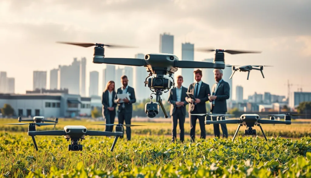
The age of drones as simple novelties has passed. Today, industrial UAVs are vital tools for productivity worldwide. The application of drones in various industries is now a standard practice. PwC estimates the global market for business services using these systems at over $127 billion.
These advanced systems transform critical operations. They enable precise monitoring and inspection of assets like power lines and crops. Drones enhance safety and boost efficiency across energy, agriculture, and disaster response areas.
We provide industry-leading technology to harness this potential. Our SRIZFLY simulators train your operators for complex real-world missions. This approach cuts training costs by up to 50 percent while mastering data acquisition and planning.
Your success drives our mission. We guide you through a landscape where drone technology reshapes management and mitigates risk. Start your 10-day free trial with SRIZFLY today. Experience how our innovative solutions prepare your team for the future.
Key Takeaways
- Industrial drones are now essential productivity assets, with a global market value exceeding $127 billion.
- The application of drones in various industries is standard, revolutionizing sectors like energy, agriculture, and disaster response.
- Drones enable precise monitoring, inspection, and data acquisition, enhancing safety and operational efficiency.
- SRIZFLY’s advanced simulators train operators for complex missions, reducing training costs by up to 50%.
- Drone technology is reshaping asset management, planning, and risk mitigation strategies.
- A 10-day free trial offers a risk-free way to experience SRIZFLY’s simulator solutions.
- Adopting innovative drone solutions is key to staying competitive in modern industrial operations.
Revolutionizing Power Inspection: Enhancing Grid Efficiency
Inspecting miles of high-voltage lines used to mean sending teams into hazardous terrain. Crews faced risks from heights, wildlife like snakes, and harsh weather. This manual process was slow and left gaps in grid monitoring.
We utilize the JOUAV CW series VTOL drone to change this. It offers 8 hours of flight and a 100km radio link. This endurance allows for autonomous, long-range power line inspections.
Your maintenance teams get a powerful tool. High-definition thermal cameras spot overheating components early. Real-time data transmission lets personnel monitor infrastructure from a central computer.
This technology is vital after disasters like floods. Drones safely survey tower bases without risking lives. Our simulators prepare your staff for these complex missions in any condition.
| Aspect | Traditional Manual Inspection | SRIZFLY Drone Solution |
|---|---|---|
| Safety | High risk from heights, wildlife, weather | Inspectors remain safely on the ground |
| Coverage | Limited by terrain and human stamina | 100km range per mission |
| Data Detail | Visual notes, limited perspective | HD & thermal imagery, AI analytics |
| Response Time | Days to mobilize crew | Rapid deployment for emergencies |
| Cost Efficiency | High labor, vehicle, and insurance costs | Reduced by up to 50% with simulators |
This approach transforms grid management. It boosts operational efficiency and ensures a consistent, secure power supply.
Transforming Urban Traffic Monitoring and Management
Managing city traffic flow requires a bird’s-eye view that ground-based systems simply cannot provide. We deploy UAVs to create a dynamic, three-dimensional management system. This covers water, land, and air for smooth urban mobility.
Your traffic management teams gain a powerful tool for live monitoring. We enable government departments to regulate flow from a macro level. This helps solve persistent congestion by identifying illegal lane occupancy quickly.
Small drones arrive at accident scenes in minutes. They capture intuitive, high-resolution pictures for determining responsibility. Our systems provide the crucial data support to quickly restore normal operations.
Flexible drone solutions eliminate blind corners in traditional law enforcement. They ensure comprehensive street coverage. You can improve response efficiency for inspections and rescues in both wide roads and narrow alleys.
Our SRIZFLY simulators let your operators practice complex traffic scenarios. This ensures they handle unexpected incidents with precision. We help you build a safer urban environment by integrating this technology into your existing management systems.
Advancing Environmental Protection and Law Enforcement
Modern environmental challenges require innovative tools capable of detecting pollution at its source, day or night. We provide aerial systems that monitor air, soil, vegetation, and water quality in real-time. This vigilance is critical for tracking incidents and safeguarding public health.
Your team can use our far-infrared night photography technology. It enables all-weather aerial monitoring of corporate wastewater discharge. This capability works regardless of space or difficult terrain.
Our drones come equipped with specialized acquisition and analysis equipment. They allow environmental departments to monitor factory emissions effectively. You gain the accurate data needed for immediate law enforcement action.
We support environmental governance in unique ways. Our systems can spray catalysts into the air to eliminate smog, similar to agricultural applications. This proactive approach helps reduce pollution and ensures corporate compliance.
SRIZFLY simulators prepare your officers to operate these UAVs in challenging conditions. They practice identifying pollution sources with high accuracy. This training enhances the safety and efficiency of your field operations.
We are dedicated to providing the technology that helps you protect natural resources. You can trust our expertise for reliable monitoring, law enforcement, and long-term ecological analysis.
Aerial Confirmation of Rights and Land Disputes
The global adoption of UAV remote sensing is revolutionizing how land rights are confirmed and disputes are settled. Traditional surveying methods are slow and often lack the precision needed for clear documentation.
We provide high-precision remote sensing technology. Your organization can accurately confirm rural land rights and territorial boundaries from the air.
This approach saves significant workforce and material resources. Our drones replace time-consuming ground measurement methods in large or difficult areas.
The resulting data is highly accurate and essential for resolving disputes. You gain clear, indisputable documentation of property lines.
We help streamline the entire confirmation process. Large-scale territorial surveys become manageable with minimal human intervention.
Our simulators let your surveying teams practice flight planning for mapping. They learn to capture perfect data on the first attempt, boosting operational efficiency.
We are committed to providing tools for transparent land management. You can rely on our expertise for the most advanced solutions in this critical field.
Enhancing Agricultural Insurance and Crop Monitoring
Farmers and insurers alike are turning to the sky for accurate field assessments and risk management. This shift is powered by commercial UAVs equipped with advanced multispectral and thermal sensors.
We provide drone systems with specialized cameras. They deliver precise measurements of planting areas for insurance plots. Your teams gain vital data on crop growth and soil health throughout the season.
Your insurance adjusters can assess risk and document damage with high efficiency. This simplifies the entire claims settlement process with clear aerial imagery. Farmers use the same intelligence to implement targeted measures, reducing losses before they threaten yield.
Our SRIZFLY simulators prepare your agricultural specialists to operate these drones over vast fields. We ensure you collect consistent, reliable information for better portfolio management. You can trust our expertise for the most reliable precision agriculture solutions in the United States.
Streamlining Express Delivery and Rural Logistics
Commercial drone delivery moved from concept to reality with pivotal FAA approvals and global partnerships. In 2019, the FAA approved UPS Flight Forward as the first-ever drone airline. This followed the 2016 partnership between Flirtey and Domino’s for the first pizza delivery by a commercial UAV in New Zealand.
We provide autonomous delivery drones that transport parcels, food, and medical supplies to remote areas with high efficiency. Your logistics operations benefit from our precision release systems. They enable fast delivery where ground transit is difficult or impossible.

Our systems excel in middle-mile logistics, shuttling cargo between distribution hubs. This reduces the need for expensive manned flight operations. We also help expand your capacity with heavy-lift unmanned aircraft for industrial or bulk goods.
You can achieve high-speed logistics in Tier 4 and Tier 5 cities without complex ground infrastructure. Our SRIZFLY simulators allow your team to practice BVLOS (Beyond Visual Line of Sight) operations. This ensures safe and reliable delivery performance from day one.
We are committed to providing the technology that makes last-mile delivery a practical and cost-effective solution. You can rely on our expertise for the most advanced drone systems for all your express delivery and rural logistics requirements.
Innovative Post-disaster Rescue and Rapid Response
Innovative drone technology is transforming how we conduct search, rescue, and recovery operations. When every minute is critical, these systems provide the eyes in the sky that first responders desperately need.
Real-world cases prove their value. After Hurricane Harvey in 2017, drones were used to repair power lines in Houston. In 2018, they provided infrared images in Hechingen, Germany, helping firefighters locate precise areas for water supply.
We provide drones with high-definition cameras for rapid incident assessment. Your rescue teams can use our thermal imaging to locate missing individuals, even at night. Our systems help identify crucial relief areas and select the safest routes for your personnel.
You can monitor fire spread and hotspots in real-time. This data is vital for controlling wildfires and protecting firefighter safety. Our solutions also accelerate recovery planning by capturing detailed imagery and 3D models of damaged infrastructure.
Our SRIZFLY simulators prepare your emergency teams to operate in dangerous environments. They practice making informed decisions quickly. Start your 10-day free trial to experience how we help save lives and restore services after disasters.
Cutting-edge Remote Sensing, Surveying, and Mapping
Creating a digital twin of the physical world starts with capturing millions of precise data points from the air. We provide the advanced drone systems to make this happen.
Your surveying teams can use our fixed-wing and VTOL drones equipped with LiDAR scanners. These systems generate high-precision 3D models for any project. Our photogrammetry solutions track construction progress and measure earthwork volumes with extreme accuracy.
This technology is vital for emergency mapping after earthquakes or mudslides. It provides rapid terrain assessments for security planning. We help you identify ground movement and landslide risks in mining zones.
| Surveying Aspect | Traditional Methods | Drone-Based Solution |
|---|---|---|
| Data Acquisition Speed | Weeks for large sites | Hours for same coverage |
| Topographic Accuracy | Limited sample points | Continuous, centimeter-grade detail |
| Operational Cost | High labor & equipment fees | Reduced by up to 60% |
| Team Safety | Risks in rugged terrain | Personnel operate from safe zones |
Our SRIZFLY simulators let your surveyors practice automated flight planning. This ensures they capture perfectly consistent data for every mapping mission. We deliver the technology that makes geospatial work more efficient and cost-effective.
Elevating Street View and Cinematic Filming
Capturing breathtaking aerial footage once required costly helicopter rentals and complex permits. Today, agile UAVs deliver that same cinematic power. Major news networks lead this shift.
In 2016, CNN launched a dedicated Unmanned Aerial Systems unit. This move showcased the practical use of drones for live reporting. The Drone Racing League, founded in 2015, further proves the precision of this technology.

We provide drones with high-definition cameras for stunning perspectives. Your production teams can execute complex shots like chasing cars. Our systems keep journalists safe while covering conflicts or natural disasters.
You can also create engaging advertising content. Drones display banners or perform aerial stunts. This approach replaces expensive manned aircraft with agile, cost-effective solutions.
| Aspect | Traditional Filming | Drone-Based Solution |
|---|---|---|
| Cost | Very high (helicopters, crew) | Reduced by up to 70% |
| Safety | Risk to pilots & camera operators | Personnel operate from the ground |
| Shot Flexibility | Limited by aircraft maneuverability | Dynamic angles and tight spaces |
| Setup Time | Hours for permits and logistics | Rapid deployment in minutes |
| Data Quality | Standard HD footage | 4K/6K resolution & stable gimbals |
Our SRIZFLY simulators prepare your camera operators. They practice flying in confined spaces to capture the perfect shot. This training ensures efficiency and safety for all your operations.
We are dedicated to elevating your visual storytelling. You can trust our expertise for reliable drone systems and planning support. Start your 10-day free trial to experience professional-grade simulation.
Strengthening Security, Surveillance, and Emergency Response
From transporting critical medical supplies to patrolling vast industrial sites, drones are becoming indispensable for modern security. In a landmark case, a 2.8-mile drone trip delivered a kidney for transplant in Baltimore in just 10 minutes. This showcases the life-saving potential of rapid UAV response.
We provide drones equipped with AI-driven video analytics. Your security teams can automate perimeter patrols and detect intrusions in real-time. Thermal sensors enable 24/7 monitoring of industrial zones, ensuring faster alerts.
Our systems support large-area surveillance for ports and national borders. They offer extended endurance and wide-area visibility. You can also oversee crowd movement during public events with powerful zoom cameras.
This technology improves workplace safety. It allows you to check restricted access areas without exposing personnel to danger. Our SRIZFLY simulators prepare your staff to operate in complex environments.
We are committed to providing the tools that strengthen your security infrastructure. You can rely on our expertise for advanced drone systems in all your security and emergency response planning.
Application of drones in various industries
Autonomous flight and AI vision have propelled drones from niche gadgets to essential productivity engines. By 2025, these industrial UAVs are indispensable instruments across different sectors.
Modern industrial drones are total operational systems. They integrate airborne platforms, sensors, software, and data-processing tools into a single solution.
We provide comprehensive drone solutions tailored to specific needs. Your organization in energy, infrastructure, agriculture, or construction can benefit.
Our integrated systems combine dependable platforms with advanced sensors. This enables mission-critical tasks in high-risk or difficult-to-access areas.
You improve decision-making through actionable data and real-time analytics. This technology transforms experimental drone use into necessary productivity tools.
| Operational Aspect | Legacy Approach | Drone-Integrated System |
|---|---|---|
| Data Collection | Manual, slow, and often incomplete | Automated, continuous, and highly accurate |
| Risk Management | Personnel exposed to hazards | Remote operations enhance safety |
| Decision Speed | Delays waiting for field reports | Live insights enable immediate planning |
| System Scalability | Limited by crew size and logistics | Easily scales across sites and applications |
Our SRIZFLY simulators let your staff master industrial drone operations. They prepare for the complexities of modern work environments.
We are dedicated to driving industry growth. You can trust our expertise for reliable, scalable drone systems for all commercial requirements.
Conclusion
This exploration reveals a clear trend: drones are now fundamental to operational excellence. They transform safety and efficiency across countless operations.
Your business can gain a competitive edge with proper training. Our SRIZFLY simulators prepare your team to master this technology.
Experience the benefits firsthand with our 10-day free trial. We provide reliable systems and actionable data for your specific needs.
We invite you to contact our team. Your success is our priority as we guide you through this evolving landscape.

