



The world of unmanned aerial vehicles has evolved significantly over the past century. From basic remote piloting to advanced platforms, the journey has been remarkable. Today, systems like SRIZFLY’s virtual simulation offer a controlled environment to develop and test models before actual drone operations.
FlySight’s OPENSIGHT is a prime example of this evolution. With over a decade of development, it adheres to STANAG guidelines and efficiently processes data from multispectral cameras. This modular platform combines operational support with cutting-edge technology.
As we delve into the intricacies of recognition training, we will explore realistic scenarios and the importance of human supervision. These elements are crucial for preparing modern UAV teams for safer missions. The advancements in this field not only enhance capabilities but also pave the way for future innovations.
Key Takeaways
- UAV technology has a rich history spanning over 100 years.
- SRIZFLY’s system enables safe pre-flight training for drone operations.
- FlySight’s OPENSIGHT exemplifies a modular approach to unmanned aerial systems.
- More than 10 years of development ensure reliability and compliance with guidelines.
- Focus on realistic scenarios and human oversight enhances mission safety.
What UAV AI Recognition Means for Modern Drone Operations
Unmanned aerial vehicles have transformed from simple tools to sophisticated systems in modern aviation. This evolution has led to the development of automated detection and classification systems. These systems monitor objects, aircraft, and activities within airborne data streams.
The European Space Agency has pointed out that the increasing density of drones poses a significant challenge for airspace safety. As more vehicles take to the skies, reliable model-based detection becomes crucial, especially near sensitive areas.
Computer vision plays a vital role in distinguishing between drones, birds, and aircraft. This capability is essential when radio-frequency monitoring falls short. Such technology aids in protecting airports, securing infrastructure, and enhancing emergency responses.
While AI supports modern drone operations, it is important to remember that human oversight remains critical. Accountability is key, especially during safety-critical decisions. As one expert noted,
“Technology enhances our capabilities, but human judgment is irreplaceable.”
How AI Recognition Detects, Classifies, and Tracks Objects
The integration of advanced technology has transformed object detection in the realm of drones. Automatic target recognition (ATR) systems are at the forefront of this evolution. They detect, classify, and track vehicles, personnel, and infrastructure with impressive accuracy.
Computer vision plays a crucial role in this process. It scans each video frame to identify potential objects like cars, trucks, and even birds. Convolutional neural networks analyze vast datasets, comparing visual and thermal signatures to classify objects effectively.
Once an object is detected, the ATR pipeline kicks in. It follows the object through changes in direction and obstacles, maintaining tracking even in challenging conditions. This capability allows operators to receive vital information about an object’s position and speed, supporting timely decisions during missions.
“Technology enhances our capabilities, but human judgment is irreplaceable.”
How Sensor Fusion Combines Cameras and Infrared Sensors
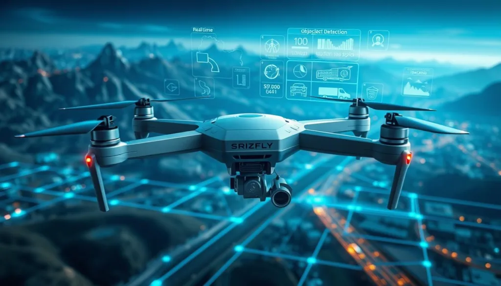
The fusion of various sensor technologies is reshaping the landscape of drone operations. Cameras offer visible detail, while infrared sensors enhance detection in low-light conditions, such as darkness or fog. This combination allows for reliable monitoring even when visibility is compromised.
DARPA has documented the effectiveness of multisensor fusion in contested environments. By integrating inputs from electro-optical cameras, thermal imaging, and radar, systems can identify fast-moving objects. The vision component refines the shape and classification of these vehicles.
Moreover, radio-frequency and acoustic signals provide additional confirmation when visual detection is limited by weather or terrain. OPENSIGHT exemplifies this by fusing multiple sensor data packets and incorporating navigation systems. This integration is crucial for providing context, ensuring that each sensor’s data contributes to a comprehensive understanding of the environment.
How a Virtual Simulation System Supports UAV AI Recognition Training
Virtual simulation systems play a crucial role in training operators for modern drone missions. They provide a safe environment to develop detection models and mission workflows without risking aircraft or equipment.
For instance, SRIZFLY’s simulator allows teams to recreate OPENSIGHT-style search patterns. This enables testing how a UAV adapts to changes in terrain, weather, or mission priorities.
Moreover, simulations can effectively demonstrate obstacle avoidance, such as navigating around power lines. This training prepares operators for real-world challenges before they encounter them during live flights.
By combining synthetic video, sensor inputs, and navigation data, teams can test complete recognition workflows. This comprehensive approach helps in identifying false positives and boosts operator confidence before deployment on both legacy and new platforms.
Building Realistic Simulation Scenarios for Different Environments
Creating effective simulation scenarios is essential for training operators of unmanned aerial vehicles. These scenarios must reflect a variety of environments to ensure comprehensive detection capabilities.
Urban settings can be particularly challenging. By incorporating buildings, reflections, and moving vehicles, simulations can test detection systems against clutter. This approach mirrors the complexities identified in UAV datasets.
Rural environments are equally important. Including elements like trees, fields, and wildlife helps models adapt to different backgrounds and object scales. Additionally, variations in weather conditions, such as fog, rain, and low light, can significantly impact aerial imagery clarity, as noted by NOAA.
Moreover, realistic emergency scenarios, such as wildfires or earthquakes, can enhance the training experience. By varying altitude, distance, and object size, operators can better prepare for real-world challenges. This multifaceted approach ensures that training data is robust and reflective of actual operational conditions.
Training and Evaluating Recognition Models with Simulation Data
Training models for object detection is crucial in developing efficient drone systems. DataVLab has supported AI teams since 2019, providing scalable annotation processes for complex image, video, and satellite-imagery projects.
Bounding boxes help teach models where to locate objects, while polygon labels capture irregular shapes and partially obscured drones. Sequence annotation demonstrates how UAV positions change across frames, supporting continuous tracking.
To evaluate model performance, it’s essential to define metrics for detection accuracy, classification quality, and false-positive rates. Comparing results across different weather, altitude, and background variations ensures models are robust before operational integration.
By utilizing simulation data, operators can enhance their learning experience. This comprehensive approach aids in refining detection models and prepares teams for real-world missions.
Real-Time Processing, Edge AI, and Situational Awareness
The rise of real-time data processing is revolutionizing the way drones operate in various environments. Edge AI allows for video processing directly on the UAV, reducing the need to send data to remote servers. This not only minimizes latency but also ensures that bandwidth is used efficiently.
For example, Maris-Tech platforms enhance performance by providing high-quality video analytics onboard. This integration supports faster detection and improves situational awareness, especially in disconnected environments.
Onboard models can seamlessly combine inputs from cameras and infrared sensors. This fusion of data enables operators to make informed decisions while the aircraft is airborne. Additionally, AI-driven swarms can coordinate multiple units, expanding coverage for search and surveillance missions.
Common UAV Recognition Challenges, from False Positives to Processing Limits
Navigating the complexities of drone operations reveals several challenges in detection systems. One major issue is small-object detection. Drones can appear as little as a few pixels wide in camera feeds. This requires high-resolution sensors and specialized models to ensure accurate identification.
Weather conditions also play a critical role. According to NOAA, fog, rain, and glare can severely reduce image clarity. These factors hinder the reliability of detection systems, making it difficult to distinguish between objects.
False positives are another concern. Birds, debris, and reflections can easily confuse detection algorithms. Such misidentifications can lead to unnecessary alerts and operational inefficiencies.
Additionally, size, weight, and power (SWaP) limitations restrict onboard processors. This affects memory, cooling, and battery use, limiting the complexity of deployable models. To address these challenges, simulation-based stress testing is recommended. This approach helps measure performance under various conditions, including noise and occlusion.
UAV AI Recognition Applications in Security, Search and Rescue, and Disaster Response
The applications of drone technology are expanding rapidly across various sectors. Security teams can utilize aerial systems to detect unauthorized aircraft near runways and terminals. This proactive approach helps prevent potential disruptions before they escalate.
In disaster response, drones play a crucial role. They can map gas pipelines, inspect dam walls for microcracks, and identify wildfire hot spots from the air. These capabilities allow teams to gather vital data quickly and efficiently.
OPENSIGHT enhances search-and-rescue operations by overlaying information on real-time maps. This integration refines search patterns, improving response times in critical situations.
Law enforcement can also benefit from drone surveillance. By analyzing crowd flow and monitoring restricted zones, they can ensure public safety while respecting privacy. Human review remains essential to maintain accountability.
As noted by the European Space Agency (ESA) and the European Union Aviation Safety Agency (EASA), the growing density of drones poses safety concerns. This highlights the importance of using aerial systems in monitoring airports, borders, and energy sites.
Integrating Simulation into UAV Operations with Human Oversight
Incorporating simulation technology into drone operations enhances decision-making processes. This approach allows operators to rehearse AI-assisted decisions while ensuring human authority over mission-critical actions remains intact.
FlySight’s OPENSIGHT can be retrofitted into legacy systems, demonstrating the importance of thoughtful integration planning for existing fleets. Clear approval points must be defined for target confirmation, sensor tasking, route changes, and emergency responses.
Additionally, testing operator workload, alert timing, and model confidence is crucial before introducing new systems into live operations. This reinforces that AI and enhanced reality serve as tools for safer decisions, not replacements for trained personnel or accountable command structures.
Conclusion
Useful aerial decisions begin when raw video, sensor inputs, and imagery become clear information. UAV recognition tools can support detection, object tracking, and mission planning by combining data from several sensors.
Simulation lets crews test models across varied environments, object types, weather, processing limits, and response needs before live operations. Edge AI, sensor fusion, computer vision, and human oversight each serve a distinct role. Together, these systems can improve awareness while keeping operators in control.
FlySight’s OPENSIGHT remains relevant through modular integration, real-time analysis, and decision support across platforms. These tools help teams assess activity and manage changing mission demands. Explore SRIZFLY’s virtual simulator to practice realistic scenarios, evaluate models, and prepare for safer UAV operations.