
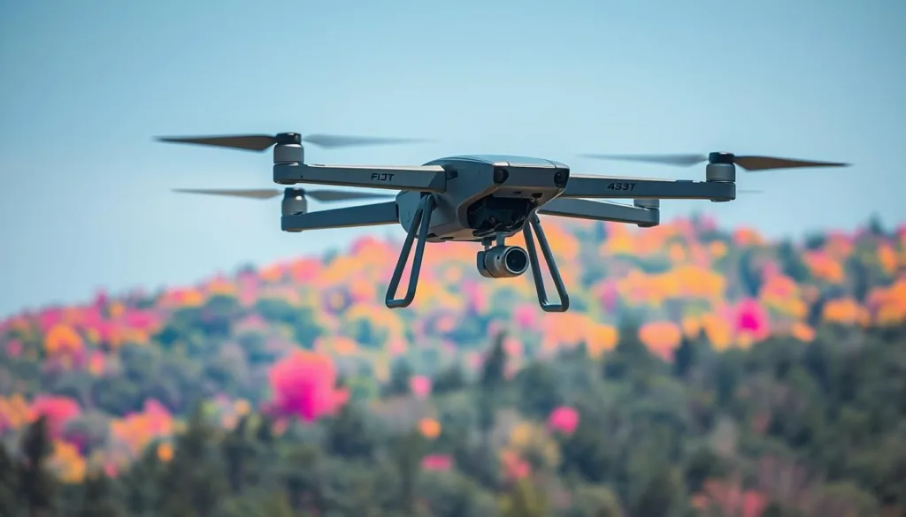
Modern aerial surveillance and traffic monitoring are getting a major upgrade. New technology lets teams test and improve systems without the risks of real flights.
Pioneers like Microsoft Corporation have created powerful tools for this. Their open-source AirSim plug-in generates highly detailed thermal data for drones in a virtual space.
This approach solves big problems. It cuts down the huge expense and legal hurdles of gathering real-world infrared data. Teams get a safe, controlled sandbox to train advanced object detection software.
By mixing virtual reality with physics-based models, these platforms can create endless scenarios. This builds rich, varied datasets that were once nearly impossible to collect.
Key Takeaways
- Virtual testing of drone sensors is changing how we develop surveillance and traffic systems.
- Open-source projects, like Microsoft’s AirSim, are leading this innovation.
- Simulation dramatically reduces the cost and legal barriers of real-flight data collection.
- It provides a completely safe environment for refining object recognition algorithms.
- These virtual tools can generate a wide variety of realistic training data.
- This technology is crucial for advancing automated monitoring and analysis.
Overview of UAV Simulated Infrared Imaging
The Unreal Engine 19 platform serves as the foundation for generating detailed thermal scenes. This powerful game engine renders complex environments where heat signatures behave realistically.
An infrared image created here provides crucial training data for deep learning models. Teams can develop object detection software without deploying expensive drone hardware.
Developers use the AirSim plug-in to simulate different sensor types. This includes thermal cameras that enhance the skills of autonomous aerial vehicles.
The main goal is to close the gap between virtual data and real-world performance. Especially for monitoring traffic from the sky, this technology is a game-changer.
Research shows this approach is very cost-effective. However, the quality of the synthetic thermal picture must keep improving to match physical sensors.
Historical Research and Technological Advances
The journey of creating synthetic thermal data began with pioneering academic work in the early 2000s. This early research laid the groundwork for today’s advanced virtual testing platforms.
Each step forward has made it easier and cheaper to develop powerful aerial monitoring systems.
Notable Studies and Milestones
One key study by Yang et al. utilized Vega Prime’s Ondulus IR software. They generated simulated infrared pictures of complex outdoor scenes.
Another important project was led by Pszczel et al. Their work focused on tropical marine environments using the VIRSuite software.
These projects were crucial. They showed how to model thermal radiation and atmospheric effects digitally.
Evolving Simulation Methods
A comprehensive review of the field reveals a clear trend. Early methods often depended on costly commercial tools like JRM or SE-Workbench.
The focus has shifted toward more accessible, open-source frameworks. This evolution has democratized the research process.
Each new method builds on previous work, creating better and more realistic synthetic environments for training.
Applications in Traffic Monitoring and Beyond
From managing city traffic to protecting national borders, this technology proves its value in countless ways. Thermal vision from above helps officials track vehicle flow and spot accidents quickly, even at night.
It also plays a key role in rescue missions and watching over the environment. These diverse applications show why the field is growing so fast.
National Defense and Civil Applications
For national security, unmanned aerial systems with thermal sensors are vital. They can detect threats in places where radar does not work well. This high-sensitivity capability is crucial for complex environments.
On the civilian side, search teams use the same tech to find people by their heat signatures. This works in smoke, fog, or darkness. Wildlife experts also use it to monitor animals without disturbing them.
The versatility of these applications drives research into better testing methods. Creating robust systems for all these scenarios is a top priority.
Principles of Infrared Imaging and Thermal Radiation
Two key physical concepts form the backbone of all credible thermal simulation: blackbody radiation and atmospheric effects. Getting these right is what separates a basic graphic from a scientifically useful synthetic scene.
Planck’s Blackbody Radiation Fundamentals
Every object emits energy based on its heat. Planck’s law describes this mathematically. The law uses a specific constant, 3.7418 × 10⁻¹⁶ W m², to calculate the radiation.
Understanding the temperature distribution of a target is essential here. A warmer engine block and a cooler roof will have very different radiation values. This data feeds directly into creating a realistic thermal picture.
Atmospheric Attenuation Essentials
The air between the sensor and the target is not empty. Gases like carbon dioxide (CO2) and water vapor (H2O) absorb infrared signals.
Specialized software, such as MODTRAN, models this attenuation. It provides critical information on how much of a target’s thermal signature actually reaches the camera. Ignoring this effect makes synthetic data less reliable.
Accurate modeling also requires balancing heat flux. The Stefan-Boltzmann constant, with a value of 5.67 × 10⁻⁸ W/(m²·K⁴), helps calculate the energy emitted from a drone’s surface. Combining all these principles ensures the final simulated image reflects true thermal characteristics.
UAV simulated infrared imaging: Model and Method
A new algorithmic approach is transforming how we create synthetic heat-based imagery. This technique builds on existing platforms to deliver more accurate and reliable data for training.
The proposed method calculates the grayscale value of object surfaces using infrared radiation models. It ensures the final output contains realistic thermal details that mirror the real world.
Simulation Algorithm Overview
This improved algorithm integrates 3D model segmentation. Different regions of an object receive distinct ID numbers based on their material properties.
This systematic process allows for the generation of high-quality synthetic data. That data is perfect for training advanced object detection models.
The simulation process concludes by adding a calculated amount of noise to the infrared image. This crucial step mimics the interference found in real-world sensor data.
By refining these calculations, the method produces a more precise and useful infrared image for analysis. It represents a significant step forward in virtual testing.
Enhanced AirSim Techniques for Infrared Simulation
A critical upgrade in virtual testing involves dissecting 3D models based on material properties and heat profiles. This refined approach significantly boosts the realism of thermal scenes generated for analysis.
3D Segmented Model Processing
The core of this enhancement lies in a detailed modeling process. Specialists use software like 3D Max to split vehicles into distinct thermal regions.
For example, a car’s engine, glass windows, and metal body are each treated as separate modules. This separation allows the system to assign accurate heat signatures to every part.
As one developer noted, “Segmenting by material is the key to believable thermal output.” This meticulous workflow ensures the final synthetic data captures subtle temperature differences seen in reality.
Such high-fidelity modeling directly improves the overall quality of the training datasets. Complex traffic scenes built this way maintain excellent visual and thermal detail.
Implementing this segmentation is a vital step. It elevates the quality and usefulness of virtual environments for advancing aerial research.
Comparative Evaluation of Detection Algorithms
To determine the best tool for the job, researchers rigorously test various algorithms on specialized thermal datasets. This head-to-head analysis is crucial for advancing automated traffic systems. The performance of each model is measured using key metrics like accuracy and speed.
Efficiency of EfficientNCSP-Net
The EfficientNCSP-Net algorithm stands out in recent evaluations. It achieved a mean average precision (mAP50) greater than 96% on the challenging IR-TSS dataset. This high accuracy validates its tailored design for processing heat-based data.
Its architecture is optimized for the unique characteristics of thermal signatures. This focus leads to more reliable detection in complex scenarios like nighttime traffic monitoring.
Comparison with YOLO and RT-DETR
When benchmarked against popular models like YOLOv10 and RT-DETR, EfficientNCSP-Net shows clear advantages. The experimental results highlight its superior precision in identifying objects within thermal scenes.
“Specialized networks consistently outperform general-purpose models on this data,” noted one research lead. This comparative study proves that a custom approach yields better performance.
The findings underscore the importance of choosing the right algorithm for the sensor. For real-time applications, this efficiency in detection is a major benefit.
Infrared Image Data Collection and Associated Challenges
Gathering thermal pictures from the sky for research is a tough task, filled with roadblocks. Strict flight rules over cities and the high price of special camera equipment make real-world collection very hard. These are the main challenges teams face right from the start.
Even when a flight is possible, getting a diverse set of pictures is difficult. Researchers need many different viewing angles and weather conditions to train their software properly. This lack of variety creates a big problem.

The scarcity of large, labeled thermal datasets holds back progress. This is where creating synthetic information offers a smart way forward. It provides a cost-effective method to build massive libraries of perfect data.
Solving these collection issues is crucial. It directly fuels the advancement of smarter, more independent flying systems for our complex urban spaces.
Integrating Deep Learning with Infrared Imaging
By combining deep learning with thermal data, researchers are automating complex analysis tasks. This powerful blend allows computers to enhance picture clarity and spot details in complete darkness. It marks a major shift in how we process heat-based aerial views.
Utilizing Generative Adversarial Networks
Generative adversarial networks, or GANs, are a key tool here. They work by pitting two neural networks against each other. One creates synthetic heat-based scenes, while the other tries to spot the fakes.
This competition drives the creation of highly realistic atmospheric infrared images in real time. “GANs have revolutionized our ability to generate training data,” explains a machine learning engineer. The result is a rich, diverse dataset that mirrors real-world conditions.
Convolutional neural networks (CNNs) also play a vital role. They significantly boost the performance of detection systems in fog, rain, or snow. By training a deep learning network on this synthetic information, models learn to generalize effectively.
This integration means smarter, faster analysis of thermal scenes from the sky. It is a foundational step toward fully autonomous monitoring systems.
Impact of Weather: Clouds and Rain on Infrared Detection
The performance of heat-based sensors can be drastically altered by atmospheric phenomena such as precipitation and cloud cover. These conditions directly affect the quality of the data collected, making it harder to spot targets.
Understanding this impact is key to building reliable aerial monitoring systems that work day and night, in all weather.
Cloud Effects on Image Radiance
A layer of clouds acts like a filter in the sky. It significantly cuts down the radiance of an infrared image. Research results show that under cumulus cloud conditions, radiance can drop to around 8.0 × 10⁻⁵ W/Sr.
This reduction is often several orders of magnitude. The exact amount depends on the cloud type and how thick it is. Thicker clouds block more of the thermal signal.
Rain Attenuation Analysis
Rainfall presents another major challenge. Water droplets in the air absorb and scatter the infrared signal. This attenuation complicates detection, especially in the 8.0-12.0 micrometer wavelength band.
Measured results indicate rain radiance is much lower, approximately 1.7 × 10⁻⁵ W/Sr. This creates a distinct drop in the peak values captured by sensors, degrading the final infrared image. “Heavy rain can effectively blind a thermal camera,” one analyst noted.
Developing algorithms that account for these conditions is crucial. Robust systems must learn to see through the weather, not just around it.
Simulation of Aerial Infrared Scenes in Traffic Environments
Building a virtual traffic scene from above starts with detailed 3D models of everyday vehicles. Designers create digital versions of cars, buses, and trucks. These models form the core of the entire simulation.
Each digital object is placed with precision within the virtual world. This setup allows teams to generate an infrared image of the scene from many different viewpoints. Testing how well a detection model spots every object becomes much easier.
To make the thermal picture realistic, every object gets special thermal properties. A truck’s engine is set hotter than its cargo area. This careful assignment ensures the final infrared image matches what a real sensor would see.
This approach creates a perfect, controlled sandbox. Researchers can craft endless scenarios, from a quiet street to a jam-packed highway. It provides the ultimate test for spotting targets in a complex, multi-vehicle scene.
Creation and Evaluation of the IR-TSS Dataset
The IR-TSS dataset represents a significant leap in available resources for thermal analysis. It was built to give researchers a complete, high-quality collection for training detection models.
This resource focuses specifically on traffic scenes from an aerial perspective.

Key Dataset Features
One of the main features of this collection is its variety. It contains seven common object types found on roads.
These include people, bicycles, cars, and buses. Having such diversity is crucial for building robust software.
For comparison, another popular resource is the HIT-UAV dataset. It offers 2,029 training images for object detection research.
Both of these datasets serve as vital benchmarks. They let teams measure how well their algorithms perform.
Object Annotation Techniques
Precise labeling is what makes these datasets so useful. Each object is carefully marked for the computer to learn from.
The primary method uses axis-aligned bounding boxes. These boxes draw a simple rectangle around every target in the data.
For more advanced analysis, segmentation masks are also employed. This technique outlines the exact shape of each object.
Such detailed data is the foundation for smarter, more accurate deep learning models. It directly improves how systems interpret complex thermal scenes.
Leveraging Open-source Software in Infrared Imaging
The adoption of free, community-driven platforms is breaking down financial barriers in the development of heat-based vision systems. This shift empowers more teams to participate in cutting-edge research.
Benefits of AirSim and Unreal Engine
Using open-source software like AirSim removes the heavy cost of commercial licenses. Researchers can run high-quality tests without a huge budget. This freedom is a major advantage.
The Unreal Engine provides a powerful foundation. It builds realistic virtual worlds that mimic various sensor outputs. This platform is key for creating believable thermal scenes.
Open tools also boost teamwork and repeatability. Shared code lets others verify and build on your work. It creates a stronger, more transparent field of study.
These resources speed up innovation dramatically. New methods can be developed and tested rapidly. This accelerates the entire pace of technical progress.
Most importantly, this accessibility ensures everyone can contribute. Even groups with limited funding can advance thermal imaging technology. It democratizes the future of aerial analysis.
Innovative Approaches to Synthetic Thermal Data Generation
By scripting the entire scene creation process, teams can produce perfectly labeled thermal images at an unprecedented scale. This automated approach solves the critical shortage of real-world information for training aerial systems.
Procedural Pipeline for Data Augmentation
A procedural pipeline automates the generation of synthetic thermal pictures. It seamlessly integrates various object classes into a virtual background. This streamlined process creates vast, diverse datasets with minimal manual effort.
Researchers gain fine-tuned control over every element. They can programmatically set an object’s position, scale, and rotation within the scene. Using Blender’s Python API, developers script this entire workflow to build robust 3D models.
The pipeline ensures synthetic objects align perfectly with the scene’s viewpoint. This creates a cohesive and realistic final image. Such high-quality, varied data is essential for training reliable detection models.
These innovative methods are vital for advancing aerial robotics. They provide the rich, scalable training material that real-world collection often cannot.
Future Trends in UAV Infrared Imaging Research
Next-generation advancements promise to redefine how we perceive and process heat signatures from the sky. Future research is intensely focused on boosting the real-time performance of detection algorithms. These systems must operate flawlessly in highly dynamic, complex environments.
Emerging technologies are paving the way for this leap. Advanced thermal sensors with higher resolution are entering the market. Edge computing will allow drones to process data onboard, reducing latency.
Emerging Technologies
A key trend is multi-sensor fusion. Combining thermal data with visible light and LiDAR information creates a richer picture. This integration significantly improves the overall system performance and reliability.
Ongoing Research Challenges
Significant hurdles remain on the path to maturity. Ongoing research challenges include creating more diverse and extensive training datasets. Another major hurdle is developing models robust enough for extreme weather conditions.
These challenges must be solved to build fully autonomous systems. The end goal is reliable, long-term monitoring for surveillance and traffic tasks. The future is bright, but the work is just beginning.
Conclusion
To conclude, the fusion of synthetic environments and advanced algorithms has unlocked new potentials for sky-based monitoring systems. This article has summarized the significant strides in this field of research.
The results are clear. Generating synthetic thermal data, when paired with robust detection models, achieves high performance in tasks like traffic monitoring. This provides a safe, scalable testing ground.
We’ve underscored the vital role of standardized metrics for evaluating different algorithms. Future research must tackle data scarcity and weather variability to boost overall system performance.
By embracing open-source tools, the community is poised for more breakthroughs. The path forward is built on collaboration and innovative testing methods.

